Category:Maps of Brocken
Jump to navigation
Jump to search
Media in category "Maps of Brocken"
The following 15 files are in this category, out of 15 total.
-
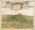 1732 illustration of Blocksberg.jpg 14,017 × 12,060; 25.49 MB
-
 Brocken aus Meyers Reisebücher.png 2,249 × 1,697; 7.76 MB
-
 Brocken L. S. Bestehorn cropped.jpg 797 × 416; 446 KB
-
 Brocken L. S. Bestehorn.jpg 1,770 × 1,517; 2.88 MB
-
 Brocken Panorama-Postkarte 1.jpg 3,287 × 2,163; 929 KB
-
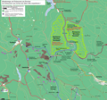 Brocken wanderwege und ruhezonen ds wv 12 2011.png 1,899 × 1,770; 1.56 MB
-
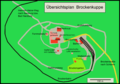
 Brocken, perspektivische Ansicht.jpg 800 × 600; 175 KB
-
 Brockenkarte C. E. Nehse.jpg 1,483 × 2,433; 752 KB
-
 Brockenkuppe wp.png 1,831 × 1,280; 320 KB
-
-
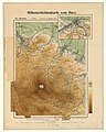
 Höhenschichten Karte des Harzgebirges, Kartenausschnitt Brocken.jpg 1,785 × 1,567; 1.89 MB
-
 Nationalpark Hochharz, Brocken Gipfel, Oct 1995 (4256971663).jpg 3,599 × 2,399; 439 KB
-
 Panorama vom Brocken.jpg 3,906 × 4,288; 6.01 MB
-
 Panorama vom Brocken.png 5,292 × 5,888; 53.6 MB
-
 Panorama-vom-brocken-60588.jpg 4,497 × 3,983; 4.27 MB


.jpg)

.jpg)


