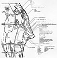
Category:Maps of Cape Canaveral Space Force Station
Jump to navigation
Jump to search
Media in category "Maps of Cape Canaveral Space Force Station"
The following 21 files are in this category, out of 21 total.
-
Aerial mosaic of Cape Canaveral and vicinity, April 1967.jpg 555 × 699; 68 KB
-
Blue Origin's Orbital Launch Pad Plan Overlay - July 2019 Revision.jpg 1,008 × 1,254; 1.15 MB
-
Canaveral.png 998 × 1,750; 2.49 MB
-
Canaveral.svg 1,000 × 1,750; 362 KB
-
Cape Canaveral Air Force Station, 1962 map.png 2,272 × 1,542; 1.35 MB
-
Cape Canaveral Florida - 1955.jpg 709 × 547; 138 KB
-
Cape Canaveral Launch Complex 45 Map.jpg 400 × 556; 46 KB
-
CCAFS Industrial Area, 1960 map.png 1,400 × 933; 253 KB
-
CCAFS Industrial Area, 2008 map.jpg 2,420 × 1,902; 924 KB
-
CCAFS2.JPG 454 × 501; 35 KB
-
KSC NASA Railroad map.jpg 1,050 × 1,181; 327 KB
-
Kscmap.gif 535 × 275; 48 KB
-
Launch complexes at Cape Canaveral Air Force Station.jpg 638 × 1,019; 440 KB
-
Launch complexes at Cape Canaveral Air Force Station.png 640 × 1,020; 436 KB
-
Launch sites at Cape Canaveral and Merritt Island.svg 640 × 1,020; 73 KB
-
Lc39 plan 1963 labelled.png 658 × 494; 83 KB
-
Lc39 plan 1963.gif 647 × 486; 38 KB
-
Map of Cape Canaveral launch facilities, 1972.jpg 860 × 872; 148 KB
-
Merrit Island 2.JPG 361 × 456; 49 KB
-
Merritt Island.jpg 733 × 1,050; 175 KB


