Category:Maps of Carroll County, New Hampshire
Jump to navigation
Jump to search
Wikimedia category | |||||
| Upload media | |||||
| Instance of | |||||
|---|---|---|---|---|---|
| Category combines topics | |||||
| Carroll County | |||||
county in New Hampshire, United States   | |||||
| Instance of | |||||
| Named after | |||||
| Location | New Hampshire | ||||
| Capital | |||||
| Inception |
| ||||
| Population |
| ||||
| Area |
| ||||
| Different from | |||||
| official website | |||||
 | |||||
Subcategories
This category has only the following subcategory.
Media in category "Maps of Carroll County, New Hampshire"
The following 23 files are in this category, out of 23 total.
-
 Carroll-Albany-NH.png 600 × 481; 12 KB
-
 Carroll-Bartlett-NH.png 600 × 481; 11 KB
-
 Carroll-Brookfield-NH.png 600 × 481; 11 KB
-
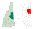
 Carroll-Chatham-NH.png 600 × 481; 11 KB
-
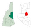
 Carroll-Conway-NH.png 600 × 481; 11 KB
-
 Carroll-Eaton-NH.png 600 × 481; 11 KB
-
 Carroll-Effingham-NH.png 600 × 481; 12 KB
-
 Carroll-Freedom-NH.png 600 × 481; 11 KB
-
 Carroll-Hale's-Location-NH.png 600 × 481; 11 KB
-
 Carroll-Hart's-Location-NH.png 600 × 481; 12 KB
-
 Carroll-Hart's-Location-NH.svg 600 × 481; 95 KB
-
 Carroll-Jackson-NH.png 600 × 481; 11 KB
-
 Carroll-Madison-NH.png 600 × 481; 11 KB
-
 Carroll-Moultonbourough-NH.png 600 × 481; 12 KB
-
 Carroll-Ossipee-NH.png 600 × 481; 12 KB
-
 Carroll-Sandwich-NH.png 600 × 481; 12 KB
-
 Carroll-Tamworth-NH.png 600 × 481; 12 KB
-
 Carroll-Tuftonboro-NH.png 600 × 481; 12 KB
-
 Carroll-Tuftonboro-NH.svg 600 × 481; 95 KB
-
 Carroll-Wakefield-NH.png 600 × 481; 12 KB
-
 Carroll-Wolfeboro-NH.png 600 × 481; 12 KB
-
 New Hampshire Senate District 3 (2010).png 1,653 × 3,000; 461 KB
-
 Nh district 1.gif 636 × 379; 28 KB


.png)
