Category:Maps of Castile and León
Jump to navigation
Jump to search
Autonomous communities of Spain: Andalusia · Aragon · Asturias · Balearic Islands · Basque Autonomous Community · Canary Islands · Cantabria · Castile and León · Castilla–La Mancha · Catalonia · Extremadura · Galicia · Community of Madrid · Region of Murcia · Navarre · La Rioja · Valencian Community · Autonomous cities: Ceuta · Melilla

Wikimedia category | |||||
| Upload media | |||||
| Instance of | |||||
|---|---|---|---|---|---|
| Category combines topics | |||||
| Castile and León | |||||
autonomous community of Spain _IberianPeninsulaNASA_(cropped).jpg)    | |||||
| Pronunciation audio | |||||
| Instance of | |||||
| Location | |||||
| Legislative body | |||||
| Executive body | |||||
| Official language | |||||
| Head of government | |||||
| Inception |
| ||||
| Highest point | |||||
| Population |
| ||||
| Area |
| ||||
| Follows |
| ||||
| official website | |||||
 | |||||
Subcategories
This category has the following 23 subcategories, out of 23 total.
Media in category "Maps of Castile and León"
The following 30 files are in this category, out of 30 total.
-

-
 Borrador de UBOST CyL (2015).svg 512 × 401; 604 KB
-
 Castile and León 1 provincias map.jpg 2,517 × 2,048; 333 KB
-
 Castile and León blank map.svg 794 × 646; 143 KB
-
 Castilla León montanas.svg 2,697 × 2,110; 7.49 MB
-
 Castilla y Leon 1 3000000.png 797 × 553; 244 KB
-
 Castilla-y-Leon Crecimiento-08-18.png 2,000 × 1,547; 775 KB
-
 Castilla-y-Leon Crecimiento-98-08.png 2,000 × 1,547; 826 KB
-
 Castilla-y-Leon Densidad-2018.png 2,000 × 1,547; 885 KB
-
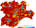
 Castilla-y-Leon Poblacion-2018.png 2,000 × 1,547; 754 KB
-
 Comarca requena-utiel en castilla.jpg 358 × 487; 45 KB
-
 Dispersión de los topillos-Castilla y Leon-2007.png 1,242 × 995; 75 KB
-

-
 Gerichtsbezirke in der autonomen Gemeinschaft Kastilien und León 2022.png 3,000 × 2,844; 2.45 MB
-
 Mapa base de Castilla y León.png 690 × 560; 54 KB
-
 Mapa de relieve y comarcas de CyL.jpg 11,313 × 8,809; 28.92 MB
-
 Mapa de ríos y embalses de CyL.jpg 14,858 × 10,663; 33.93 MB
-
 Mapacastillaleon.gif 430 × 340; 11 KB
-
 Plano orbigo.jpg 472 × 1,480; 244 KB
-
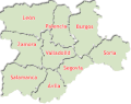
 Provincias de Castilla y León.svg 794 × 646; 200 KB
-
 Puertos Merinas Trashumancia Porma.jpg 1,210 × 744; 672 KB
-
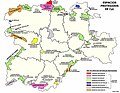 Red de Espacios Naturales de CyL.jpg 4,504 × 3,508; 3.02 MB
-
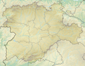 Relief map of Spain Castile and León.png 3,742 × 2,930; 16.38 MB
-
 Reliefkarte Kastilien und León 2022.png 6,771 × 5,482; 45.43 MB
-
 Riudenore mapa.png 629 × 682; 46 KB
-
 Sexmo ó Arciprestazgo de la Serrezuela.jpg 1,972 × 1,268; 231 KB
-
 SRRHIJR.jpg 1,790 × 1,686; 334 KB
-
 Villarán-España-Loc.png 640 × 366; 117 KB
-
 Ámbito de la ASCCAS.png 535 × 645; 54 KB
-
 Ámbito-ASCCAS.png 535 × 645; 62 KB
.svg)


