Category:Maps of Cold War II
Jump to navigation
Jump to search
Note that the definitions of a "second cold war" are disputed.
Media in category "Maps of Cold War II"
The following 19 files are in this category, out of 19 total.
-
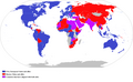
 Cold War II Map.png 2,935 × 1,499; 721 KB
-
 Cold War II Nato-Russia-China Locator.svg 2,754 × 1,398; 1.1 MB
-
 Cold War2-US+EU+allies vs Russia+China+allies.png 2,753 × 1,700; 298 KB
-
 Coldwarii.png 7,192 × 3,416; 1.68 MB
-
 Mundo en conflicto - world in conflict 2023-2024.png 2,345 × 2,373; 248 KB
-
 Mutually closed airspace 20220301.svg 553 × 553; 335 KB
-
 NATO vs. CSTO.svg 553 × 553; 376 KB
-
 Preliminary Cold War II.png 1,280 × 657; 160 KB
-
 Second Cold War alliances (political).svg 2,754 × 1,398; 1.18 MB
-
 Second Cold War alliances.svg 2,754 × 1,398; 1.18 MB
-
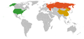
 Second Cold War America-China Pacific Locator.png 2,550 × 1,125; 331 KB
-
 Second Cold War America-China-Russia locator alternating.gif 1,200 × 1,176; 127 KB
-
 Second Cold War America-Russia Arctic Locator.png 1,654 × 1,328; 310 KB
-

-
 Second Cold War America-Russia-China Locator.svg 2,754 × 1,398; 1.05 MB
-
 Second Cold War Double Locator.png 2,065 × 1,821; 523 KB
-
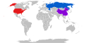
 Second Cold War locator.png 2,838 × 1,323; 438 KB
-
 Second Cold War.png 7,192 × 3,318; 1.77 MB
-
 Second Cold War.svg 2,754 × 1,398; 1.22 MB


.svg)


