Category:Maps of Courry (Gard)
Jump to navigation
Jump to search
Subcategories
This category has only the following subcategory.
T
Media in category "Maps of Courry (Gard)"
The following 7 files are in this category, out of 7 total.
-
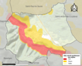 30097-Courry-argile.png 3,057 × 2,480; 2.41 MB
-
 30097-Courry-Natura2000.png 5,846 × 4,133; 4.91 MB
-
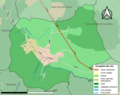
 30097-Courry-Routes-Hydro.png 3,507 × 2,480; 1.34 MB
-
 30097-Courry-Sols.png 3,270 × 2,598; 1.07 MB
-
 30097-Courry-ZNIEFF1.png 3,057 × 2,480; 2.67 MB
-
 30097-Courry-ZNIEFF2.png 3,519 × 2,480; 3.07 MB
-
 Map commune FR insee code 30097.png 756 × 605; 31 KB


