Category:Maps of Crotona Park
Jump to navigation
Jump to search
Media in category "Maps of Crotona Park"
The following 19 files are in this category, out of 19 total.
-
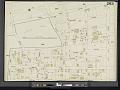 Bronx, V. 12, Double Page Plate No. 263 (Map bounded by 3rd Ave., E. 180th St., Clinton Ave., Crotona Park N.) NYPL2001521.tiff 8,973 × 6,724, 2 pages; 172.68 MB
-

-

-
 Bronx, V. 14, Plate No. 42 (Map bounded by Crotona Park East, Minford Place, Wendover Ave.) NYPL2003331.tiff 6,673 × 8,905, 2 pages; 170.07 MB
-
 Bronx, V. 14, Plate No. 61 (Map bounded by 175th St., Crotona Park East, Crotona Park South, Fulton Ave.) NYPL2003350.tiff 6,717 × 8,964, 2 pages; 172.33 MB
-
 Bronx, V. 14, Plate No. 9 (Map bounded by E. 177th St., Arthur Ave., 3rd Ave.) NYPL2003298.tiff 6,726 × 8,976, 2 pages; 172.79 MB
-
 Bronx, V. 15, Plate No. 100 (Map bounded by Crotona Park North, Crotona Ave., Clay Ave.) NYPL2002949.tiff 6,719 × 8,966, 2 pages; 172.42 MB
-
 Bronx, V. 15, Plate No. 48 (Map bounded by E. 177th St., Arthur Ave., E. 175th St., 3rd Ave.) NYPL2002897.tiff 6,713 × 8,959, 2 pages; 172.13 MB
-
 Bronx, V. 15, Plate No. 99 (Map bounded by Crotona Park, Waterloo Place, E. 176th St., Boston Rd., Crotona Park E.) NYPL2002948.tiff 6,719 × 8,966, 2 pages; 172.42 MB
-
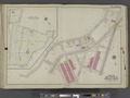 Bronx, V. 2, Double Page Plate No. 11 (Map bounded by Plan of Crotona Park, Southern Blvd., E. 170th St., Wilkins Ave.) NYPL2020920.tiff 7,207 × 5,405, 2 pages; 111.51 MB
-
 Bronx, V. 2, Double Page Plate No. 13 (Map bounded by E. Tremont Ave., Daly Ave., Crotona Park, Arthur Ave.) NYPL2020922.tiff 7,171 × 5,378, 2 pages; 110.4 MB
-

-

-

-

-
 Hyde V. 2 Plate 05 publ. 1901.jpg 7,230 × 5,428; 28.75 MB
-
 Hyde V. 2 Plate 09 publ. 1901.jpg 7,230 × 5,428; 31.45 MB
-
 Hyde V. 2 Plate 11 publ. 1901.jpg 7,230 × 5,428; 32.01 MB
-
 Sanborn Bronx V. 12 Plate 263 publ. 1896.jpg 8,063 × 5,911; 5.49 MB


