Category:Maps of Dannevirke
Jump to navigation
Jump to search
Media in category "Maps of Dannevirke"
The following 31 files are in this category, out of 31 total.
-
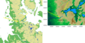
 BosætningsområderSlesvig-HolstenDannevirke.png 1,260 × 1,440; 324 KB
-
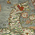 Carta Marina - Dannevirke.jpeg 800 × 800; 730 KB
-

-
 Danewerk Landenge.png 500 × 254; 168 KB
-
 Danewerk petersen plan.jpg 400 × 219; 147 KB
-
 Danewerk PONTOPPIDAN.jpg 990 × 757; 977 KB
-
 Danewerk seesperrwerk karte.jpg 425 × 371; 116 KB
-
 Danewerk waelle.jpg 600 × 413; 237 KB
-
 Danewerk.empty.png 633 × 634; 418 KB
-
 Danewerk.png 633 × 635; 525 KB
-
 DanewerkDetailmap.jpg 383 × 384; 178 KB
-
 DanewerkKograben.gif 1,098 × 984; 21 KB
-
 Dannevirke 1649.gif 1,200 × 482; 313 KB
-
 Dannevirke.english.png 2,045 × 2,048; 2.19 MB
-
 Dannevirke.png 2,045 × 2,048; 2.19 MB
-
 Dannewerk - Margarethenwall - Danewerk 04 ies.jpg 5,616 × 3,744; 9.71 MB
-
 Dannewerk - Margarethenwall - Danewerk 05 ies.jpg 5,616 × 3,744; 11.44 MB
-
 Dannewerk - Ochsenweg - Ochsenweg - Dannewerk - Tor 04 ies.jpg 5,616 × 3,744; 10.71 MB
-
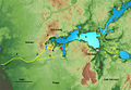
 Eider Treene2.gif 1,244 × 1,024; 104 KB
-
 Ellingstedt - Mölhornweg-Margarethenwallweg - Danewerk 02 ies.jpg 5,616 × 3,744; 7.78 MB
-
 Ellingstedt - Mölhornweg-Margarethenwallweg - Danewerk 03 ies.jpg 5,616 × 3,744; 10.17 MB
-
 Ellingstedt - Mölhornweg-Margarethenwallweg - Danewerk 04 ies.jpg 5,616 × 3,744; 9.7 MB
-
 Ellingstedt - Mölhornweg-Margarethenwallweg - Danewerk 05 ies.jpg 5,616 × 3,744; 9.26 MB
-
 Ellingstedt - Mölhornweg-Margarethenwallweg - Danewerk 07 ies.jpg 5,616 × 3,744; 9.77 MB
-
 Karte Danewerk dk.jpg 1,015 × 816; 282 KB
-
 Karte Danewerk.jpg 1,015 × 816; 288 KB
-
 Map danavirki.JPG 1,600 × 1,200; 1.17 MB
-
 Map with the Danevirke from 1539.jpg 1,105 × 1,038; 1.17 MB
-
 Osterwall-Østervold.png 1,247 × 671; 160 KB
-
 SchleisperrwerkSlispærring.png 1,162 × 538; 174 KB
-
 Spruner-Menke Handatlas 1880 Karte 49.jpg 10,465 × 8,737; 24.39 MB


