Category:Maps of Dare County, North Carolina
Jump to navigation
Jump to search
Counties of North Carolina: Alamance · Alexander · Alleghany · Anson · Ashe · Avery · Beaufort · Bertie · Bladen · Brunswick · Buncombe · Burke · Cabarrus · Caldwell · Camden · Carteret · Caswell · Catawba · Chatham · Cherokee · Chowan · Clay · Cleveland · Columbus · Craven · Cumberland · Currituck · Dare · Davidson · Davie · Duplin · Durham · Edgecombe · Forsyth · Franklin · Gaston · Gates · Graham · Granville · Greene · Guilford · Halifax · Harnett · Haywood · Henderson · Hertford · Hoke · Hyde · Iredell · Jackson · Johnston · Jones · Lee · Lenoir · Lincoln · Macon · Madison · Martin · McDowell · Mecklenburg · Mitchell · Montgomery · Moore · Nash · New Hanover · Northampton · Onslow · Orange · Pamlico · Pasquotank · Pender · Perquimans · Person · Pitt · Polk · Randolph · Richmond · Robeson · Rockingham · Rowan · Rutherford · Sampson · Scotland · Stanly · Stokes · Surry · Swain · Transylvania · Tyrrell · Union · Vance · Wake · Warren · Washington · Watauga · Wayne · Wilkes · Wilson · Yadkin · Yancey
Wikimedia category | |||||
| Upload media | |||||
| Instance of | |||||
|---|---|---|---|---|---|
| Category combines topics | |||||
| Dare County | |||||
county in North Carolina, United States   | |||||
| Instance of | |||||
| Named after | |||||
| Location | North Carolina | ||||
| Capital | |||||
| Inception |
| ||||
| Highest point | |||||
| Population |
| ||||
| Area |
| ||||
| official website | |||||
 | |||||
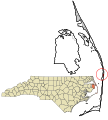
Dare County is located in North Carolina in the United States. Its county seat is Manteo.
Subcategories
This category has the following 2 subcategories, out of 2 total.
M
- Maps of Roanoke Island (26 F)
Media in category "Maps of Dare County, North Carolina"
The following 20 files are in this category, out of 20 total.
-
 Buffalo City, North Carolina map.PNG 674 × 1,418; 106 KB
-

-

-

-

-

-

-

-

-

-

-

-
-

-

-

-
 Dare County North Carolina incorporated and unincorporated areas.svg 835 × 925; 2.06 MB
-
 Map of Dare County North Carolina With Municipal and Township Labels.PNG 674 × 1,418; 106 KB
-
 Map of North Carolina highlighting Dare County.svg 8,061 × 3,056; 236 KB
-
 North Carolina Map Highlighting Dare County.PNG 531 × 201; 15 KB


