Category:Maps of Delaware County, Ohio
Jump to navigation
Jump to search
Wikimedia category | |||||
| Upload media | |||||
| Instance of | |||||
|---|---|---|---|---|---|
| Category combines topics | |||||
| Delaware County | |||||
county in Ohio, United States     | |||||
| Instance of | |||||
| Named after | |||||
| Location | Ohio | ||||
| Capital | |||||
| Headquarters location | |||||
| Inception |
| ||||
| Population |
| ||||
| Area |
| ||||
| Different from | |||||
| official website | |||||
 | |||||
Delaware County is in Ohio in the United States. Its county seat is Delaware.
Subcategories
This category has the following 3 subcategories, out of 3 total.
Media in category "Maps of Delaware County, Ohio"
The following 38 files are in this category, out of 38 total.
-
 Map of Delaware County, Ohio highlighting Ashley.svg 681 × 564; 1.77 MB
-
 Map of Delaware County, Ohio highlighting Berkshire Township.svg 681 × 564; 1.77 MB
-
 Map of Delaware County, Ohio highlighting Berlin Township.svg 681 × 564; 1.77 MB
-
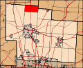
 Map of Delaware County, Ohio highlighting Brown Township.svg 681 × 564; 1.77 MB
-
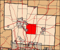
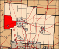
 Map of Delaware County, Ohio highlighting Concord Township.svg 681 × 564; 1.77 MB
-
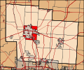 Map of Delaware County, Ohio highlighting Delaware Township.svg 681 × 564; 1.77 MB
-
 Map of Delaware County, Ohio highlighting Delaware.svg 681 × 564; 1.77 MB
-
 Map of Delaware County, Ohio highlighting Galena.svg 681 × 564; 1.77 MB
-
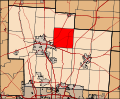
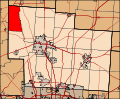
 Map of Delaware County, Ohio highlighting Genoa Township.svg 681 × 564; 1.77 MB
-
 Map of Delaware County, Ohio highlighting Harlem Township.svg 681 × 564; 1.77 MB
-
 Map of Delaware County, Ohio highlighting Kingston Township.svg 681 × 564; 1.77 MB
-
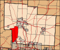
 Map of Delaware County, Ohio highlighting Liberty Township.svg 681 × 564; 1.77 MB
-
 Map of Delaware County, Ohio highlighting Marlboro Township.svg 681 × 564; 1.77 MB
-
 Map of Delaware County, Ohio highlighting Orange Township.svg 681 × 564; 1.77 MB
-
 Map of Delaware County, Ohio highlighting Ostrander.svg 681 × 564; 1.77 MB
-
 Map of Delaware County, Ohio highlighting Oxford Township.svg 681 × 564; 1.77 MB
-
 Map of Delaware County, Ohio highlighting Porter Township.svg 681 × 564; 1.77 MB
-
 Map of Delaware County, Ohio highlighting Powell.svg 681 × 564; 1.77 MB
-
 Map of Delaware County, Ohio highlighting Radnor Township.svg 681 × 564; 1.77 MB
-
 Map of Delaware County, Ohio highlighting Scioto Township.svg 681 × 564; 1.77 MB
-
 Map of Delaware County, Ohio highlighting Shawnee Hills.svg 681 × 564; 1.77 MB
-
 Map of Delaware County, Ohio highlighting Sunbury.svg 681 × 564; 1.77 MB
-
 Map of Delaware County, Ohio highlighting Thompson Township.svg 681 × 564; 1.77 MB
-
 Map of Delaware County, Ohio highlighting Trenton Township.svg 681 × 564; 1.77 MB
-
 Map of Delaware County, Ohio highlighting Troy Township.svg 681 × 564; 1.77 MB
-
 Map of Franklin and Delaware counties, Ohio highlighting Westerville.svg 697 × 1,082; 2.95 MB
-
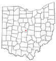
 Map of Ohio highlighting Delaware County.svg 1,050 × 1,141; 37 KB
-
 OHMap-doton-Ashley.png 274 × 300; 10 KB
-
 OHMap-doton-Delaware.png 274 × 300; 10 KB
-
 OHMap-doton-Galena.png 274 × 300; 10 KB
-
 OHMap-doton-Kilbourne.png 309 × 352; 17 KB
-
 OHMap-doton-Lewis Center.png 309 × 352; 17 KB
-
 OHMap-doton-Ostrander.png 274 × 300; 10 KB
-
 OHMap-doton-Powell.png 274 × 300; 10 KB
-
 OHMap-doton-Radnor.png 309 × 352; 17 KB
-
 OHMap-doton-Shawnee Hills Delaware County.png 274 × 300; 10 KB
-
 OHMap-doton-Sunbury.png 274 × 300; 10 KB
-
 OHMap-doton-Westerville.png 274 × 300; 10 KB


