Category:Maps of Districts of Krasnoyarsk Krai
Jump to navigation
Jump to search
Subcategories
This category has the following 45 subcategories, out of 45 total.
A
- Maps of Abansky District (3 F)
- Maps of Achinsky District (4 F)
B
- Maps of Birilyussky District (1 F)
- Maps of Bogotolsky District (1 F)
- Maps of Boguchansky District (1 F)
E
I
- Maps of Idrinsky District (1 F)
- Maps of Ilansky District (1 F)
- Maps of Irbeysky District (1 F)
K
- Maps of Kansky District (1 F)
- Maps of Karatuzsky District (1 F)
- Maps of Kazachinsky District (1 F)
- Maps of Kezhemsky District (2 F)
- Maps of Kozulsky District (1 F)
- Maps of Kuraginsky District (3 F)
M
- Maps of Mansky District (1 F)
- Maps of Minusinsky District (1 F)
- Maps of Motyginsky District (1 F)
N
- Maps of Nazarovsky District (1 F)
S
- Maps of Sayansky District (1 F)
- Maps of Sharypovsky District (1 F)
- Maps of Shushensky District (1 F)
T
- Maps of Taseyevsky District (1 F)
- Maps of Tyukhtetsky District (1 F)
U
- Maps of Uyarsky District (1 F)
- Maps of Uzhursky District (1 F)
Y
- Maps of Yeniseysky District (2 F)
- Maps of Yermakovsky District (2 F)
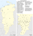
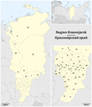
Media in category "Maps of Districts of Krasnoyarsk Krai"
The following 10 files are in this category, out of 10 total.
-
 Krasnojarski-krai-numbered.png 2,696 × 3,878; 194 KB
-
 Krasnojarski-krai-south-numbered.png 1,284 × 1,380; 1.69 MB
-
 Krasnojarski-krai-south.png 1,284 × 1,380; 35 KB
-
 Krasnojarski-krai.png 2,696 × 3,878; 193 KB
-
 Map Krasnoyarsk Krai.png 1,670 × 1,798; 395 KB
-
 Map of the Krasnoyarsk Krai (upright).png 828 × 3,352; 301 KB
-
 Map of the Krasnoyarsk Krai (with index).png 2,006 × 1,802; 634 KB
-
 Map of the Krasnoyarsk Krai - 2.png 1,545 × 1,802; 293 KB
-
 Map of the Krasnoyarsk Krai.png 1,545 × 1,802; 303 KB
-


.png)


.png)