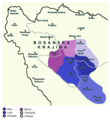
Category:Maps of Donji Kraji county of medieval Bosnian state
Jump to navigation
Jump to search
zemlja of medieval Bosnian state, historical region of Bosnia and Herzegovina | |||||
| Upload media | |||||
| Instance of |
| ||||
|---|---|---|---|---|---|
| Subclass of |
| ||||
| Part of | |||||
| Location |
| ||||
| Inception |
| ||||
| Dissolved, abolished or demolished date |
| ||||
| Replaced by | |||||
| |||||
Media in category "Maps of Donji Kraji county of medieval Bosnian state"
The following 4 files are in this category, out of 4 total.
-
Donji Kraji map.png 2,000 × 1,908; 250 KB
-
Donji Kraji per Mrgic on relief map of Bosnia-Herzeg.png 2,000 × 1,887; 6.26 MB
-
Donji Kraji.png 702 × 767; 43 KB
-
Growth of Donji Kraji and estates of HVH.png 702 × 887; 56 KB


