Category:Maps of Essen
Jump to navigation
Jump to search
Wikimedia category | |||||
| Upload media | |||||
| Instance of | |||||
|---|---|---|---|---|---|
| Category combines topics | |||||
| Essen | |||||
city in North Rhine-Westphalia, Germany     | |||||
| Pronunciation audio | |||||
| Instance of |
| ||||
| Part of | |||||
| Location | Düsseldorf Government Region, North Rhine-Westphalia, Germany | ||||
| Located in or next to body of water | |||||
| Head of government |
| ||||
| Headquarters location | |||||
| Population |
| ||||
| Area |
| ||||
| Elevation above sea level |
| ||||
| Different from | |||||
| official website | |||||
 | |||||
Subcategories
This category has the following 4 subcategories, out of 4 total.
E
- Election maps of Essen (3 F)
L
- Locator maps of districts of Essen (171 F)
O
- OpenStreetMap maps of Essen (46 F)
Media in category "Maps of Essen"
The following 16 files are in this category, out of 16 total.
-
 BurgenSchloesserHerrenhaeuserEssenundUmgebung.png 1,168 × 681; 61 KB
-
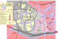
 Essen 51 Karte.png 1,880 × 1,821; 2.86 MB
-
 Essen Germany street map.svg 1,485 × 1,824; 7.41 MB
-
 Essen Kupferdreh - Dilldorfer Allee 02 ies.jpg 3,888 × 2,592; 2.42 MB
-
 Essen Kupferdreh - Hardenbergufer 05 ies.jpg 3,888 × 2,592; 2.14 MB
-
 Gemeinde St Josef Essen V2.png 1,275 × 853; 201 KB
-
 Gemeinde St Josef Essen.png 1,275 × 853; 201 KB
-
 Karte Eiberg.png 772 × 971; 94 KB
-
 Karte Königssteele.png 1,236 × 1,201; 118 KB
-
 Lage der kreisfreien Stadt Essen in Deutschland.png 176 × 234; 3 KB
-
 Lage der Stadt Essen in Deutschland.png 188 × 235; 5 KB
-
 Lageplan Holbeckshof.svg 1,488 × 1,052; 48 KB
-
 Locator map E in North Rhine-Westphalia.svg 657 × 656; 479 KB
-
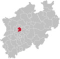 North rhine w E.png 593 × 585; 69 KB
-
 North rhine w E.svg 660 × 660; 221 KB
-
 NRW RB Düsseldorf E.svg 592 × 584; 246 KB


