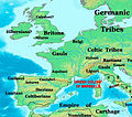
Category:Maps of Europe in the 4th century BC
Jump to navigation
Jump to search
English: This category is about the subject of Europe 400-301 BC: History maps showing all or a substantial part of the territory of Europe as it was in the 4th century BC.
Contemporary old maps belong into: Category:Old maps of Europe and its subcategories.
Contemporary old maps belong into: Category:Old maps of Europe and its subcategories.
Maps of the history of Europe: (BCE) 9th century · 8th century · 5th century · 4th century · 3rd century · 2nd century · 1st century · (CE) 1st century · 2nd century · 3rd century · 4th century · 5th century · 6th century · 7th century · 8th century · 9th century · 10th century · 11th century · 12th century · 13th century · 14th century · 15th century · 16th century · 17th century · 18th century · 19th century · 20th century · 21st century ·
Media in category "Maps of Europe in the 4th century BC"
The following 42 files are in this category, out of 42 total.
-
362BCThebanHegemony.png 2,000 × 1,882; 2.67 MB
-
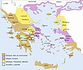
Ancient greek dialects (-400)-es.svg 660 × 555; 893 KB
-
Ancient greek dialects (-400)-fr.svg 660 × 555; 574 KB
-
Ancient greek dialects-fr-400.jpg 2,000 × 1,682; 804 KB
-
Battles of Ancient Greece 700-168 BC (Portuguese).svg 993 × 793; 3.25 MB
-
Carte de l'émigration des Sauromates - BV042518421.jpg 1,954 × 1,337; 281 KB
-
Celts, 4th century BC.png 1,220 × 847; 74 KB
-
Ciutats estat de Grècia 371-362 aC.jpg 3,702 × 2,250; 1.33 MB
-
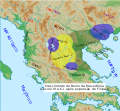
Expansion of Macedon (English).svg 992 × 794; 3.24 MB
-
Expansion of Macedon (Indonesian).svg 992 × 794; 3.24 MB
-
Expansion of Macedon (Portuguese).svg 992 × 794; 3.24 MB
-
Gallia Cisalpina-en.svg 949 × 717; 836 KB
-
Griechenland 371-362.jpg 1,800 × 1,091; 696 KB
-
Growth of the ancient Greek Kingdom of Macedon (Portuguese))v3.svg 547 × 505; 509 KB
-
Italia 400 BC-hu.svg 747 × 890; 152 KB
-
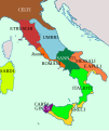
Italia 400 BC.svg 747 × 890; 147 KB
-
Italie -400.JPG 747 × 890; 120 KB
-
Italy 400bC en.svg 747 × 890; 146 KB
-
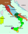
Italy 400bC es.svg 747 × 890; 186 KB
-
Italy 400bC id.svg 747 × 890; 146 KB
-
Italy 400bC It.svg 747 × 890; 184 KB
-
Italy 400bC pt.svg 747 × 890; 112 KB
-
Italy 400BC zh.svg 747 × 890; 145 KB
-
Italy IV century BC - Latina.svg 1,033 × 1,298; 1.31 MB
-
Italy IV century BC - Portuguese.svg 1,033 × 1,298; 1.33 MB
-
LangEur-300.jpg 815 × 571; 402 KB
-
Map Greece 1928-1940 - Touring Club Italiano CART-TRC-38.jpg 7,501 × 6,414; 29.05 MB
-
Map Macedonia 336 BC-ka.svg 992 × 794; 3.54 MB
-
Map Macedonia 336 BC-ru.svg 992 × 794; 3.29 MB
-
Map of europe in 385 BC.jpg 1,273 × 894; 526 KB
-
Marseilles Greek colony 323 BCE.jpg 457 × 402; 74 KB
-
Mediterrâneo pré-romano e Europa Celta.jpg 660 × 465; 52 KB
-
Theban hegemony 362 BC-es.svg 2,094 × 1,869; 7.68 MB
-
Theban hegemony 362 BC.svg 2,094 × 1,869; 13.09 MB
-
West Mediterranean Areas 306 BC.png 1,340 × 937; 2.06 MB
-
West Mediterranean areas 306BC (2)-fr.svg 980 × 720; 449 KB
-
West Mediterranean areas 306BC-el.svg 812 × 408; 1.12 MB
-
West Mediterranean areas 306BC-es.svg 812 × 408; 1.12 MB
-
West Mediterranean areas 306BC-fr.svg 812 × 408; 1.12 MB
-
West Mediterranean areas 306BC-it.svg 812 × 408; 1.15 MB
-
West Mediterranean areas 348BC-fr (2).svg 980 × 720; 443 KB
-
לאטיום וסביבותיה בעת העתיקה.PNG 546 × 370; 19 KB


