Category:Maps of Finistère
Jump to navigation
Jump to search
Departments of Metropolitan France: Ain [01] · Aisne [02] · Allier [03] · Alpes-de-Haute-Provence [04] · Hautes-Alpes [05] · Alpes-Maritimes [06] · Ardèche [07] · Ardennes [08] · Ariège [09] · Aube [10] · Aude [11] · Aveyron [12] · Bouches-du-Rhône [13] · Calvados [14] · Cantal [15] · Charente [16] · Charente-Maritime [17] · Cher [18] · Corrèze [19] · Corse-du-Sud [2A]† · Haute-Corse [2B]† · Côte-d’Or [21] · Côtes-d'Armor [22] · Creuse [23] · Dordogne [24] · Doubs [25] · Drôme [26] · Eure [27] · Eure-et-Loir [28] · Finistère [29] · Gard [30] · Haute-Garonne [31] · Gers [32] · Gironde [33] · Hérault [34] · Ille-et-Vilaine [35] · Indre [36] · Indre-et-Loire [37] · Isère [38] · Jura [39] · Landes [40] · Loir-et-Cher [41] · Loire [42] · Haute-Loire [43] · Loire-Atlantique [44] · Loiret [45] · Lot [46] · Lot-et-Garonne [47] · Lozère [48] · Maine-et-Loire [49] · Manche [50] · Marne [51] · Haute-Marne [52] · Mayenne [53] · Meurthe-et-Moselle [54] · Meuse [55] · Morbihan [56] · Moselle [57] · Nièvre [58] · Nord [59] · Oise [60] · Orne [61] · Pas-de-Calais [62] · Puy-de-Dôme [63] · Pyrénées-Atlantiques [64] · Hautes-Pyrénées [65] · Pyrénées-Orientales [66] · Bas-Rhin [67] · Haut-Rhin [68] · departmental district of the Rhône [69] · Rhône [69D]‡ · Metropolis of Lyon [69M]‡ · Haute-Saône [70] · Saône-et-Loire [71] · Sarthe [72] · Savoie [73] · Haute-Savoie [74] · Paris [75] · Seine-Maritime [76] · Seine-et-Marne [77] · Yvelines [78] · Deux-Sèvres [79] · Somme [80] · Tarn [81] · Tarn-et-Garonne [82] · Var [83] · Vaucluse [84] · Vendée [85] · Vienne [86] · Haute-Vienne [87] · Vosges [88] · Yonne [89] · Territoire de Belfort [90] · Essonne [91] · Hauts-de-Seine [92] · Seine-Saint-Denis [93] · Val-de-Marne [94] · Val-d'Oise [95]
Overseas departments and regions: Guadeloupe [971] · Martinique [972] · French Guiana [973] · Réunion [974] · Mayotte [976]
Overseas collectivities: Saint Pierre and Miquelon [975] · Saint Barthélemy [977] · Saint-Martin [978] · Wallis and Futuna [986] · French Polynesia [987] · French Southern and Antarctic Lands [984]+
Sui generis territories: New Caledonia [988] · Clipperton Island [989]+
Wikimedia category | |||||
| Upload media | |||||
| Instance of | |||||
|---|---|---|---|---|---|
| Category combines topics | |||||
| Finistère | |||||
French department      | |||||
| Instance of | |||||
| Location | Brittany, Q88521114, Metropolitan France, France | ||||
| Capital | |||||
| Legislative body |
| ||||
| Head of government |
| ||||
| Inception |
| ||||
| Highest point | |||||
| Population |
| ||||
| Area |
| ||||
| official website | |||||
 | |||||
Subcategories
This category has the following 22 subcategories, out of 22 total.
!
- SVG maps of Finistère (51 F)
*
D
E
G
H
I
- Iroise sea maps (15 F)
M
- Maps of hills of Finistère (2 F)
- Maps of presqu'île de Crozon (9 F)
O
- Orthophotos of Finistère (4 F)
T
Media in category "Maps of Finistère"
The following 29 files are in this category, out of 29 total.
-
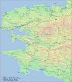
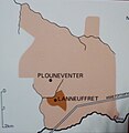 026 Carte de Plounéventer et Lanneuffret.JPG 1,841 × 1,896; 1.33 MB
-
 Cables sous-marins France, Algérie, Tunisie - btv1b531583161 (07 of 12).jpg 12,720 × 9,196; 14.34 MB
-
 Cap Caval.jpg 1,398 × 1,288; 138 KB
-
 Cap Sizun Implantations modernes.jpg 6,233 × 2,230; 1.39 MB
-
 Carte de Ya d'ar brezhoneg 2020.png 886 × 753; 196 KB
-
 Carte du Pays d'Iroise.JPG 4,039 × 3,029; 2.63 MB
-
 Carte Pays Glazik le bon.jpg 938 × 846; 112 KB
-
 Carte Pays Glazik.jpg 938 × 846; 112 KB
-
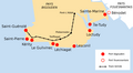
 Carteroute29.jpg 501 × 516; 98 KB
-
 Coiffe penn sardin domaine.png 866 × 794; 67 KB
-
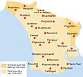
 Finistère.gif 1,500 × 1,709; 1.14 MB
-
 Iroise sea map-fr.svg 776 × 867; 406 KB
-
 Journal.pone.0173037.g001.png 2,228 × 1,711; 815 KB
-
 Kartenn ar mirva.png 1,060 × 856; 1.21 MB
-
 La forêt sous-marine de Loctudy.jpg 626 × 803; 252 KB
-
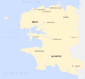 P&bfinistère.gif 769 × 709; 12 KB
-
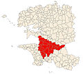
 Pays Bigouden frontière nord et est.png 1,270 × 772; 77 KB
-
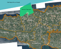
 Pays Bigouden situation.png 1,216 × 1,676; 20 KB
-
 Plan de la maison.jpg 567 × 436; 20 KB
-
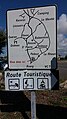 Plounéour-Trez - Panneau Route Touristique.jpeg 2,322 × 4,128; 2.99 MB
-
 Ports bigoudens 2.png 1,350 × 1,230; 149 KB
-
 Ports bigoudens.png 2,304 × 1,264; 124 KB
-
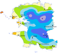 Précipitation dept29.png 623 × 575; 29 KB
-
 PSM V51 D030 Stature and health distribution of finisterre.png 1,792 × 834; 416 KB
-
 Rivière Aulne carte.png 4,488 × 2,680; 1.3 MB
-
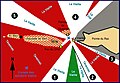 Schéma balisage nuit.jpg 1,227 × 852; 283 KB
-
 Schéma simplifié du balisage de nuit.jpg 1,227 × 852; 253 KB
-
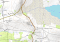
 Situation Porz Beac'h.jpg 2,208 × 1,242; 692 KB
-
 St michel de Brasparts topo.png 1,076 × 752; 713 KB

.jpg)


