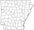
Category:Maps of Fort Smith, Arkansas
Jump to navigation
Jump to search
Subcategories
This category has only the following subcategory.
Media in category "Maps of Fort Smith, Arkansas"
The following 7 files are in this category, out of 7 total.
-
ARMap-doton-Fort Smith.png 300 × 262; 13 KB
-
Coltons plans of U.S. harbors (Ft Smith).jpg 278 × 229; 101 KB
-
Fort smith park map.jpg 1,978 × 873; 408 KB
-
Fort Smith, Arkansas 1955 Yellow Book.jpg 800 × 606; 139 KB
-
Interstate 540 (AR) map.svg 1,028 × 610; 308 KB


