Category:Maps of French Somaliland
Jump to navigation
Jump to search
Media in category "Maps of French Somaliland"
The following 11 files are in this category, out of 11 total.
-
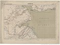 Carte de la côte française (...)Meunier Alexandre btv1b53062311r 1.jpg 1,399 × 1,054; 300 KB
-
 Carte de la côte française des Somalis et régions avoisinantes, Harrar.jpg 1,392 × 1,054; 337 KB
-
 Cheik-Saïd 1938.jpg 468 × 661; 133 KB
-
 Côte des Somalis et dépendances.jpg 1,288 × 1,054; 412 KB
-
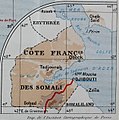 Côte Somalis 1923.jpg 626 × 631; 289 KB
-
 French East africa.png 2,000 × 2,000; 1.12 MB
-
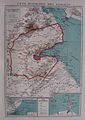
 French Somaliland 1922.jpg 1,665 × 1,081; 494 KB
-
 French Somaliland 1931 map.jpg 1,217 × 1,469; 1.52 MB
-
 French Somaliland- Status of Boundaries - DPLA - e466001eb8496cc2ce075bfa7875d1d1.jpg 5,997 × 6,720; 5.51 MB
-
 Somalia1911.png 963 × 976; 847 KB
-

Meunier_Alexandre_btv1b53062311r_1.jpg)


