Category:Maps of Gerde
Jump to navigation
Jump to search
Subcategories
This category has the following 4 subcategories, out of 4 total.
A
- Administrative maps of Gerde (2 F)
E
- Ecological maps of Gerde (3 F)
Media in category "Maps of Gerde"
The following 7 files are in this category, out of 7 total.
-
 65198-Gerde - Localisation.png 2,000 × 2,480; 1.04 MB
-
 65198-Gerde-argile.jpg 3,057 × 2,480; 657 KB
-
 65198-Gerde-Hydro.png 7,015 × 4,960; 5.44 MB
-
 65198-Gerde-Orthophoto.png 7,015 × 4,960; 5.85 MB
-
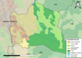 65198-Gerde-Sols.png 7,015 × 4,960; 5.69 MB
-
 Localisation de Gerde dans les Hautes-Pyrénées 1.pdf 1,754 × 2,481; 617 KB
-
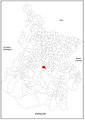
 Map commune FR insee code 65198.png 756 × 605; 42 KB


