Category:Maps of Giethoorn
Jump to navigation
Jump to search
Wikimedia category | |||||
| Upload media | |||||
| Instance of | |||||
|---|---|---|---|---|---|
| Category combines topics | |||||
| Giethoorn | |||||
former municipality in the Netherlands   | |||||
| Instance of |
| ||||
| Location | Overijssel, Netherlands | ||||
| Population |
| ||||
 | |||||
Media in category "Maps of Giethoorn"
The following 12 files are in this category, out of 12 total.
-
 1832 Vliegerstaart map.jpg 1,297 × 830; 267 KB
-
 1887 Map of Vliegerstaart.png 569 × 552; 814 KB
-

-
 Giethoorn, Gemeenteatlas van Nederland.jpg 3,062 × 2,341; 2.33 MB
-

-

-
-
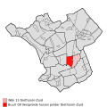
 Map - NL - Steenwijkerland - Wijk 13 Giethoorn-Zuid.svg 625 × 575; 25 KB
-
-

-

-
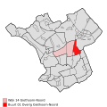
 Map - NL - Steenwijkerland - Wijk 14 Giethoorn-Noord.svg 625 × 575; 25 KB


.jpg)