Category:Maps of Guildford
Jump to navigation
Jump to search
Media in category "Maps of Guildford"
The following 21 files are in this category, out of 21 total.
-
The earth and its inhabitants (1881) (14597597680).jpg 1,866 × 2,080; 702 KB
-
Aldershot, Ash, Shalford, Basingstoke, Guildford & Peasmarsh , Wimbledon RJD 4.jpg 2,861 × 1,890; 776 KB
-
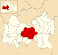
Guildford unparished area UK locator map.svg 1,342 × 1,266; 467 KB
-
Location map United Kingdom Guildford Central.png 2,006 × 1,339; 1.64 MB
-
Map of Old Albury - geograph.org.uk - 669325.jpg 640 × 480; 65 KB
-
North Downs Way Map - geograph.org.uk - 460470.jpg 640 × 480; 135 KB
-
Ockham, Wisley and Hatchford in 1786.jpg 6,808 × 5,019; 7.7 MB
-
Ordnance Survey One-Inch Sheet 124 Guildford & Horsham, Published 1920.jpg 12,218 × 8,493; 46.21 MB
-
Ordnance Survey One-Inch Sheet 125 Dorking and Leith Hill, Published 1914.jpg 12,770 × 8,283; 52.01 MB
-
Ordnance Survey One-Inch Sheet 169 Aldershot, Published 1940.jpg 8,245 × 9,566; 11.92 MB
-
Ordnance Survey One-Inch Sheet 169 Aldershot, Published 1959.jpg 8,315 × 9,946; 12.82 MB
-
Ordnance Survey One-Inch Sheet 169 Aldershot, Published 1971.jpg 11,011 × 13,141; 52.75 MB
-
Ordnance Survey One-inch Sheet 170 London S.W., Published 1970.jpg 11,019 × 13,216; 74.32 MB
-
Ordnance Survey One-Inch Sheet 170 London SW, Published 1945.jpg 8,187 × 9,560; 13.79 MB
-
Ordnance Survey One-Inch Tourist Map of Dorking & Leith Hill Published 1929.jpg 13,183 × 9,778; 15.71 MB
-
The Lovelace Bridges Trail - geograph.org.uk - 550631.jpg 480 × 640; 153 KB


