Category:Maps of Haida Gwaii
Jump to navigation
Jump to search
Media in category "Maps of Haida Gwaii"
The following 13 files are in this category, out of 13 total.
-
Alaska Panhandle-relief.png 1,176 × 731; 1.44 MB
-
Haida Gwaii Map.png 1,447 × 2,001; 94 KB
-
Haida Gwaii map.svg 744 × 1,052; 6.03 MB
-
Haida Gwaii region map.png 1,800 × 2,982; 2.18 MB
-
HaidaGwaii2022OSM.png 4,071 × 5,916; 11.17 MB
-
Inside Passage map.png 729 × 723; 303 KB
-
Isles de la Reine Charlotte (19577044531).jpg 6,192 × 3,808; 3.85 MB
-
NWCoast1a.png 761 × 529; 172 KB
-
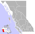
Queen Charlotte City, British Columbia Location.png 713 × 698; 57 KB
-
Queen Charlotte Islands Map.png 496 × 759; 23 KB
-
Queen Charlotte Islands map.svg 1,712 × 1,992; 335 KB
-
Queen Charlotte Islands, off the coast of BC.png 514 × 748; 35 KB
-
Queen charlotte islands.png 677 × 1,164; 36 KB


