Category:Maps of Henry County, Ohio
Jump to navigation
Jump to search
Wikimedia category | |||||
| Upload media | |||||
| Instance of | |||||
|---|---|---|---|---|---|
| Category combines topics | |||||
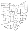
| Henry County | |||||
county in Ohio, United States    | |||||
| Instance of | |||||
| Named after | |||||
| Location | Ohio | ||||
| Capital | |||||
| Inception |
| ||||
| Population |
| ||||
| Area |
| ||||
| Different from | |||||
| official website | |||||
 | |||||
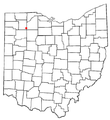
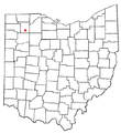
Henry County is in northwest Ohio in the United States. Its county seat is Napoleon.
Subcategories
This category has the following 3 subcategories, out of 3 total.
Media in category "Maps of Henry County, Ohio"
The following 27 files are in this category, out of 27 total.
-
 Damascus Twp Henry OH.PNG 530 × 551; 21 KB
-
 Deshler Twp Henry OH.PNG 530 × 551; 22 KB
-
 Flatrock Twp Henry OH.PNG 530 × 551; 22 KB
-
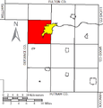
 Freedom Twp Henry OH.PNG 530 × 551; 22 KB
-
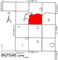 Harrison Twp Henry OH.PNG 530 × 551; 22 KB
-
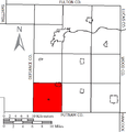
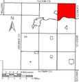
 Liberty Twp Henry OH.PNG 530 × 551; 22 KB
-
 Map of Ohio highlighting Henry County.svg 1,050 × 1,141; 37 KB
-
 Marion Twp Henry OH.PNG 530 × 551; 22 KB
-
 Monroe Twp Henry OH.PNG 530 × 551; 22 KB
-
 Napoleon Twp Henry OH.PNG 530 × 551; 21 KB
-
 OHMap-doton-Colton.png 309 × 352; 17 KB
-
 OHMap-doton-Deshler.png 274 × 300; 10 KB
-
 OHMap-doton-Florida.png 274 × 300; 10 KB
-
 OHMap-doton-Grelton.png 309 × 352; 17 KB
-
 OHMap-doton-Hamler.png 274 × 300; 10 KB
-
 OHMap-doton-Holgate.png 274 × 300; 10 KB
-
 OHMap-doton-Liberty Center.png 274 × 300; 10 KB
-
 OHMap-doton-Malinta.png 274 × 300; 10 KB
-
 OHMap-doton-McClure.png 274 × 300; 10 KB
-
 OHMap-doton-Napoleon.png 274 × 300; 10 KB
-
 OHMap-doton-New Bavaria.png 274 × 300; 10 KB
-
 OHMap-doton-Okolona.png 309 × 352; 17 KB
-
 OHMap-doton-Ridgeville Corners.png 309 × 352; 17 KB
-
 Pleasant Twp Henry OH.PNG 530 × 551; 22 KB
-
 Richfield Twp Henry OH.PNG 530 × 551; 21 KB
-
 Ridgeville Twp Henry OH.PNG 530 × 551; 22 KB
-
 Washington Twp Henry OH.PNG 530 × 551; 22 KB


