Category:Maps of Ilhéus
Jump to navigation
Jump to search
Wikimedia category | |||||
| Upload media | |||||
| Instance of | |||||
|---|---|---|---|---|---|
| Category combines topics | |||||
| Ilhéus | |||||
municipality of Bahia State, Brazil     | |||||
| Instance of | |||||
| Location | Bahia, Brazil | ||||
| Inception |
| ||||
| Population |
| ||||
| Area |
| ||||
| Elevation above sea level |
| ||||
| Electorate |
| ||||
| official website | |||||
 | |||||
Media in category "Maps of Ilhéus"
The following 17 files are in this category, out of 17 total.
-
 Apresentação de Relatório de Impacto Ambiental Porto Sul 2011-2.jpg 2,126 × 1,417; 700 KB
-
 Apresentação de Relatório de Impacto Ambiental Porto Sul 2011.jpg 2,126 × 1,417; 436 KB
-
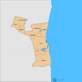
 Bahia Municip Ilheus.svg 659 × 691; 843 KB
-
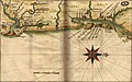
 Capitania dos Ilheos por J.T. de Albernaz 1627.jpg 3,783 × 2,591; 889 KB
-
 Distritos de Ilhéus.svg 825 × 825; 29 KB
-
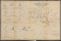 Estado da Bahia - município de Ilhéus 1946.pdf 5,472 × 3,658; 5.25 MB
-
 Ilhéus (1818) (180 degree rotated).jpg 1,664 × 936; 660 KB
-
 Ilhéus (1818) B.jpg 1,664 × 936; 661 KB
-
 Ilhéus (1818).jpg 912 × 517; 135 KB
-
 Ilhéus 1818 - BR RJANRIO BI - BA2 014 (page 94 crop).jpg 8,901 × 6,378; 3.26 MB
-
 Ilhéus 1818 - BR RJANRIO BI - BA2 014 (page 95 crop).jpg 8,920 × 6,345; 6.11 MB
-
 Mapa da Capitania de Ilhéus 1640-PT-TT-CRT-162 m0096.jpg 2,574 × 1,848; 746 KB
-
 Mapa da Capitania de Ilhéus 1640.jpg 2,172 × 1,351; 444 KB
-
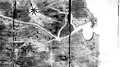
 Topographic Map of Part of Ilheos District WDL909 (cropped).png 674 × 1,156; 1.43 MB
-
 Topographic Map of Part of Ilheos District WDL909.png 1,024 × 1,494; 2.45 MB
-
 Tupinambá.png 1,008 × 1,344; 155 KB
-
 Zonais.jpg 930 × 1,600; 182 KB


_(180_degree_rotated).jpg)
_B.jpg)
.jpg)
.jpg)
.jpg)


.png)


