Category:Maps of Isesaki, Gunma
Jump to navigation
Jump to search
Media in category "Maps of Isesaki, Gunma"
The following 30 files are in this category, out of 30 total.
-
 Isesaki in Gunma Prefecture Ja.svg 501 × 523; 11 KB
-
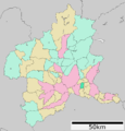
 Isesaki in Gunma Prefecture.png 1,081 × 901; 42 KB
-
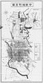 Isesaki town map.jpg 3,917 × 7,402; 2.03 MB
-
 IsesakiGunma Location.png 530 × 550; 73 KB
-
 伊勢崎市.png 662 × 980; 31 KB
-
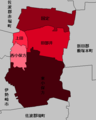
 伊勢崎市の学区.png 662 × 980; 31 KB
-
 伊勢崎市中心市街地.png 134 × 284; 3 KB
-
 伊勢崎市域の変遷.gif 950 × 1,298; 113 KB
-
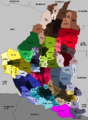
 伊勢崎市(町名入り).png 750 × 1,030; 42 KB
-
 佐波東村の学区.png 406 × 508; 10 KB
-
 佐波郡境町.png 460 × 632; 19 KB
-
 佐波郡東村.png 406 × 508; 10 KB
-
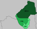
 佐波郡赤堀町.png 950 × 495; 19 KB
-
 新・伊勢崎市.png 950 × 1,298; 83 KB
-
 旧・三郷村.png 440 × 344; 5 KB
-
 旧・伊勢崎町.png 134 × 284; 3 KB
-
 旧・名和村.png 310 × 392; 8 KB
-
 旧・宮郷村.png 330 × 341; 6 KB
-
 旧・殖蓮村.png 247 × 361; 6 KB
-
 旧・茂呂村.png 231 × 248; 4 KB
-
 旧・豊受村.png 325 × 270; 7 KB
-
 群馬境町の学区.png 460 × 632; 15 KB
-
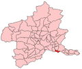
 群馬県伊勢崎市 2.png 188 × 158; 13 KB
-
 群馬県伊勢崎市.png 981 × 1,024; 43 KB
-
 群馬県佐波郡境町.png 981 × 1,024; 43 KB
-
 群馬県佐波郡東村.png 981 × 1,024; 43 KB
-
 群馬県佐波郡赤堀町.png 981 × 1,024; 43 KB
-
 群馬県境町.png 188 × 158; 14 KB
-
 群馬県尾島町.png 188 × 158; 13 KB
-
 赤堀町の学区.png 950 × 495; 17 KB


