Category:Maps of Kananaskis Country
Jump to navigation
Jump to search
Media in category "Maps of Kananaskis Country"
The following 8 files are in this category, out of 8 total.
-
 Elbow-Falls AB Map 2022-09-22.jpg 6,016 × 4,016; 15.49 MB
-
 Elbow-Falls AB Trail-Map 2022-09-22.jpg 6,016 × 4,016; 14.68 MB
-
 Kananaskis Bragg Creek and Elbow River.png 773 × 793; 36 KB
-
 Kananaskis Canmore.png 773 × 793; 35 KB
-
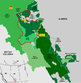
 Kananaskis Elbow Sheep Wildland Provincial Park.png 773 × 793; 35 KB
-
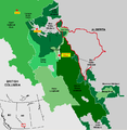 Kananaskis North Eastern Kananaskis.png 773 × 793; 36 KB
-
 Kananaskis Peter Lougheed Provincial Park.png 773 × 793; 35 KB
-
 Kananaskis South Kananaskis.png 773 × 793; 36 KB


