Category:Maps of KwaZulu-Natal municipalities with 2006 borders
Jump to navigation
Jump to search
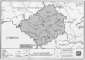
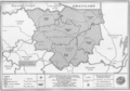
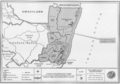
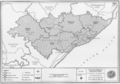
This category contains maps of municipalities in the KwaZulu-Natal province of South Africa that show the the municipal borders as they were after the municipal election of 1 March 2006. The borders of many municipalities changed again in 2011.
Media in category "Maps of KwaZulu-Natal municipalities with 2006 borders"
The following 157 files are in this category, out of 157 total.
-
 Blank map of KwaZulu-Natal (2006).svg 663 × 754; 2.17 MB
-
 DC21 locator.svg 952 × 1,000; 512 KB
-
 DC22 locator.svg 952 × 1,000; 512 KB
-
 DC23 locator.svg 952 × 1,000; 512 KB
-
 DC24 locator.svg 952 × 1,000; 512 KB
-
 DC25 locator.svg 952 × 1,000; 512 KB
-
 DC26 locator.svg 952 × 1,000; 512 KB
-
 DC27 locator.svg 952 × 1,000; 512 KB
-
 DC28 locator.svg 952 × 1,000; 512 KB
-
 DC29 locator.svg 952 × 1,000; 512 KB
-
 DC43 locator.svg 952 × 1,000; 512 KB
-
 ETH locator.svg 952 × 1,000; 512 KB
-
 KwaZulu-Natal Municipalities showing eThekwini.png 1,147 × 862; 19 KB
-
 KwaZulu-Natal Municipalities Template.png 1,147 × 862; 19 KB
-
 KZ211 locator.svg 952 × 1,000; 512 KB
-
 KZ212 locator.svg 952 × 1,000; 512 KB
-
 KZ213 locator.svg 952 × 1,000; 512 KB
-
 KZ214 locator.svg 952 × 1,000; 512 KB
-
 KZ215 locator.svg 952 × 1,000; 512 KB
-
 KZ216 locator.svg 952 × 1,000; 512 KB
-
 KZ221 locator.svg 952 × 1,000; 512 KB
-
 KZ222 locator.svg 952 × 1,000; 512 KB
-
 KZ223 locator.svg 952 × 1,000; 512 KB
-
 KZ224 locator.svg 952 × 1,000; 512 KB
-
 KZ225 locator.svg 952 × 1,000; 512 KB
-
 KZ226 locator.svg 952 × 1,000; 512 KB
-
 KZ227 locator.svg 952 × 1,000; 512 KB
-
 KZ232 locator.svg 952 × 1,000; 512 KB
-
 KZ233 locator.svg 952 × 1,000; 512 KB
-
 KZ234 locator.svg 952 × 1,000; 512 KB
-
 KZ235 locator.svg 952 × 1,000; 512 KB
-
 KZ236 locator.svg 952 × 1,000; 512 KB
-
 KZ241 locator.svg 952 × 1,000; 512 KB
-
 KZ242 locator.svg 952 × 1,000; 512 KB
-
 KZ244 locator.svg 952 × 1,000; 512 KB
-
 KZ245 locator.svg 952 × 1,000; 512 KB
-
 KZ252 locator.svg 952 × 1,000; 512 KB
-
 KZ253 locator.svg 952 × 1,000; 512 KB
-
 KZ254 locator.svg 952 × 1,000; 512 KB
-
 KZ261 locator.svg 952 × 1,000; 512 KB
-
 KZ262 locator.svg 952 × 1,000; 512 KB
-
 KZ263 locator.svg 952 × 1,000; 512 KB
-
 KZ265 locator.svg 952 × 1,000; 512 KB
-
 KZ266 locator.svg 952 × 1,000; 512 KB
-
 KZ271 locator.svg 952 × 1,000; 512 KB
-
 KZ272 locator.svg 952 × 1,000; 512 KB
-
 KZ273 locator.svg 952 × 1,000; 512 KB
-
 KZ274 locator.svg 952 × 1,000; 512 KB
-
 KZ275 locator.svg 952 × 1,000; 512 KB
-
 KZ281 locator.svg 952 × 1,000; 512 KB
-
 KZ282 locator.svg 952 × 1,000; 512 KB
-
 KZ283 locator.svg 952 × 1,000; 512 KB
-
 KZ284 locator.svg 952 × 1,000; 512 KB
-
 KZ285 locator.svg 952 × 1,000; 512 KB
-
 KZ286 locator.svg 952 × 1,000; 512 KB
-
 KZ291 locator.svg 952 × 1,000; 512 KB
-
 KZ292 locator.svg 952 × 1,000; 512 KB
-
 KZ293 locator.svg 952 × 1,000; 512 KB
-
 KZ294 locator.svg 952 × 1,000; 512 KB
-
 KZ5a1 locator.svg 952 × 1,000; 512 KB
-
 KZ5a2 locator.svg 952 × 1,000; 512 KB
-
 KZ5a4 locator.svg 952 × 1,000; 512 KB
-
 KZ5a5 locator.svg 952 × 1,000; 512 KB
-
 KZ5a6 locator.svg 952 × 1,000; 512 KB
-
 KZDMA22 locator.svg 952 × 1,000; 512 KB
-
 KZDMA23 locator.svg 952 × 1,000; 512 KB
-
 KZDMA27 locator.svg 952 × 1,000; 512 KB
-
 KZDMA43 locator.svg 952 × 1,000; 512 KB
-
 Map No. 22 of Schedule 2 to Notice 1998 of 2005.png 2,800 × 1,950; 3.57 MB
-
 Map No. 23 of Schedule 2 to Notice 1998 of 2005.png 2,800 × 1,950; 3.66 MB
-
 Map No. 24 of Schedule 2 to Notice 1998 of 2005.png 2,800 × 1,950; 3.92 MB
-
 Map No. 25 of Schedule 2 to Notice 1998 of 2005.png 2,800 × 1,950; 3.84 MB
-
 Map No. 26 of Schedule 2 to Notice 1998 of 2005.png 2,800 × 1,950; 3.7 MB
-
 Map No. 27 of Schedule 2 to Notice 1998 of 2005.png 2,800 × 1,950; 3.86 MB
-
 Map No. 28 of Schedule 2 to Notice 1998 of 2005.png 2,800 × 1,950; 3.92 MB
-
 Map No. 29 of Schedule 2 to Notice 1998 of 2005.png 2,800 × 1,950; 3.65 MB
-
 Map No. 30 of Schedule 2 to Notice 1998 of 2005.png 2,800 × 1,950; 3.72 MB
-
 Map No. 31 of Schedule 2 to Notice 1998 of 2005.png 2,800 × 1,950; 3.68 MB
-
 Map No. 32 of Schedule 2 to Notice 1998 of 2005.png 3,000 × 2,100; 4.27 MB
-
 Map of KwaZulu-Natal with Abaqulusi highlighted (2006).svg 712 × 805; 657 KB
-
 Map of KwaZulu-Natal with Amajuba highlighted (2006).svg 712 × 805; 660 KB
-
 Map of KwaZulu-Natal with Big Five False Bay highlighted (2006).svg 712 × 805; 656 KB
-
 Map of KwaZulu-Natal with Dannhauser highlighted (2006).svg 712 × 805; 653 KB
-
 Map of KwaZulu-Natal with Edumbe highlighted (2006).svg 712 × 805; 656 KB
-
 Map of KwaZulu-Natal with Emadlangeni highlighted (2006).svg 712 × 805; 662 KB
-
 Map of KwaZulu-Natal with Emnambithi-Ladysmith highlighted (2006).svg 712 × 805; 657 KB
-
 Map of KwaZulu-Natal with Endumeni highlighted (2006).svg 712 × 805; 652 KB
-
 Map of KwaZulu-Natal with Ethekwini highlighted (2006).svg 712 × 805; 659 KB
-
 Map of KwaZulu-Natal with Ezingoleni highlighted (2006).svg 712 × 805; 653 KB
-
 Map of KwaZulu-Natal with Greater Kokstad highlighted (2006).svg 712 × 805; 660 KB
-
 Map of KwaZulu-Natal with Hibiscus Coast highlighted (2006).svg 712 × 805; 657 KB
-
 Map of KwaZulu-Natal with Hlabisa highlighted (2006).svg 712 × 805; 660 KB
-
 Map of KwaZulu-Natal with Ilembe highlighted (2006).svg 712 × 805; 671 KB
-
 Map of KwaZulu-Natal with Imbabazane highlighted (2006).svg 712 × 805; 651 KB
-
 Map of KwaZulu-Natal with Impendle highlighted (2006).svg 712 × 805; 652 KB
-
 Map of KwaZulu-Natal with Indaka highlighted (2006).svg 712 × 805; 651 KB
-
 Map of KwaZulu-Natal with Ingwe highlighted (2006).svg 712 × 805; 657 KB
-
 Map of KwaZulu-Natal with Jozini highlighted (2006).svg 712 × 805; 666 KB
-
 Map of KwaZulu-Natal with Kwa Sani highlighted (2006).svg 712 × 805; 656 KB
-
 Map of KwaZulu-Natal with KwaDukuza highlighted (2006).svg 712 × 805; 653 KB
-
 Map of KwaZulu-Natal with Mandeni highlighted (2006).svg 712 × 805; 653 KB
-
 Map of KwaZulu-Natal with Maphumulo highlighted (2006).svg 712 × 805; 657 KB
-
 Map of KwaZulu-Natal with Mbonambi highlighted (2006).svg 712 × 805; 654 KB
-
 Map of KwaZulu-Natal with Mkhambathini highlighted (2006).svg 712 × 805; 655 KB
-
 Map of KwaZulu-Natal with Mpofana highlighted (2006).svg 712 × 805; 650 KB
-
 Map of KwaZulu-Natal with Msinga highlighted (2006).svg 712 × 805; 660 KB
-
 Map of KwaZulu-Natal with Msunduzi highlighted (2006).svg 712 × 805; 650 KB
-
 Map of KwaZulu-Natal with Mthonjaneni highlighted (2006).svg 712 × 805; 656 KB
-
 Map of KwaZulu-Natal with Mtubatuba highlighted (2006).svg 712 × 805; 656 KB
-
 Map of KwaZulu-Natal with municipalities blank (2006).svg 712 × 805; 1.84 MB
-
 Map of KwaZulu-Natal with Ndwedwe highlighted (2006).svg 712 × 805; 656 KB
-
 Map of KwaZulu-Natal with Newcastle highlighted (2006).svg 712 × 805; 657 KB
-
 Map of KwaZulu-Natal with Nkandla highlighted (2006).svg 712 × 805; 663 KB
-
 Map of KwaZulu-Natal with Nongoma highlighted (2006).svg 712 × 805; 663 KB
-
 Map of KwaZulu-Natal with Nquthu highlighted (2006).svg 712 × 805; 661 KB
-
 Map of KwaZulu-Natal with Ntambanana highlighted (2006).svg 712 × 805; 654 KB
-
 Map of KwaZulu-Natal with Okhahlamba highlighted (2006).svg 712 × 805; 658 KB
-
 Map of KwaZulu-Natal with Richmond highlighted (2006).svg 712 × 805; 654 KB
-
 Map of KwaZulu-Natal with Sisonke highlighted (2006).svg 712 × 805; 680 KB
-
 Map of KwaZulu-Natal with the Sisonke DMA highlighted (2006).svg 712 × 805; 660 KB
-
 Map of KwaZulu-Natal with the Umgungundlovu DMA highlighted (2006).svg 712 × 805; 647 KB
-
 Map of KwaZulu-Natal with the Umkhanyakude DMA highlighted (2006).svg 712 × 805; 682 KB
-
 Map of KwaZulu-Natal with the Uthukela DMA highlighted (2006).svg 712 × 805; 655 KB
-
 Map of KwaZulu-Natal with Ubuhlebezwe highlighted (2006).svg 712 × 805; 657 KB
-
 Map of KwaZulu-Natal with Ugu highlighted (2006).svg 712 × 805; 675 KB
-
 Map of KwaZulu-Natal with Ulundi highlighted (2006).svg 712 × 805; 660 KB
-
 Map of KwaZulu-Natal with Umdoni highlighted (2006).svg 712 × 805; 650 KB
-
 Map of KwaZulu-Natal with Umgungundlovu highlighted (2006).svg 712 × 805; 674 KB
-
 Map of KwaZulu-Natal with Umhlabuyalingana highlighted (2006).svg 712 × 805; 662 KB
-
 Map of KwaZulu-Natal with Umhlathuze highlighted (2006).svg 712 × 805; 653 KB
-
 Map of KwaZulu-Natal with Umkhanyakude highlighted (2006).svg 712 × 805; 671 KB
-
 Map of KwaZulu-Natal with Umlalazi highlighted (2006).svg 712 × 805; 664 KB
-
 Map of KwaZulu-Natal with Umngeni highlighted (2006).svg 712 × 805; 650 KB
-
 Map of KwaZulu-Natal with Umshwathi highlighted (2006).svg 712 × 805; 657 KB
-
 Map of KwaZulu-Natal with Umtshezi highlighted (2006).svg 712 × 805; 656 KB
-
 Map of KwaZulu-Natal with Umuziwabantu highlighted (2006).svg 712 × 805; 658 KB
-
 Map of KwaZulu-Natal with Umvoti highlighted (2006).svg 712 × 805; 662 KB
-
 Map of KwaZulu-Natal with Umzimkhulu highlighted (2006).svg 712 × 805; 662 KB
-
 Map of KwaZulu-Natal with Umzinyathi highlighted (2006).svg 712 × 805; 674 KB
-
 Map of KwaZulu-Natal with Umzumbe highlighted (2006).svg 712 × 805; 657 KB
-
 Map of KwaZulu-Natal with Uphongolo highlighted (2006).svg 712 × 805; 661 KB
-
 Map of KwaZulu-Natal with Uthukela highlighted (2006).svg 712 × 805; 664 KB
-
 Map of KwaZulu-Natal with Uthungulu highlighted (2006).svg 712 × 805; 679 KB
-
 Map of KwaZulu-Natal with Vulamehlo highlighted (2006).svg 712 × 805; 654 KB
-
 Map of KwaZulu-Natal with Zululand highlighted (2006).svg 712 × 805; 675 KB
-
 South Africa Districts showing Amajuba.png 1,141 × 828; 31 KB
-
 South Africa Districts showing eThekwini.png 1,141 × 828; 31 KB
-
 South Africa Districts showing iLembe.png 1,141 × 828; 31 KB
-
 South Africa Districts showing KZ.png 1,141 × 828; 31 KB
-
 South Africa Districts showing Sisonke.png 1,141 × 828; 31 KB
-
 South Africa Districts showing Ugu.png 1,141 × 828; 31 KB
-
 South Africa Districts showing Umgungundlovu.png 1,141 × 828; 31 KB
-
 South Africa Districts showing Umkhanyakude.png 1,141 × 828; 31 KB
-
 South Africa Districts showing Umzinyathi.png 1,141 × 828; 31 KB
-
 South Africa Districts showing Uthukela.png 1,141 × 828; 31 KB
-
 South Africa Districts showing uThungulu.png 1,141 × 828; 31 KB
-
 South Africa Districts showing Zululand.png 1,141 × 828; 31 KB


.svg)
.svg)
.svg)
.svg)
.svg)
.svg)
.svg)
.svg)
.svg)
.svg)
.svg)
.svg)
.svg)
.svg)
.svg)
.svg)
.svg)
.svg)
.svg)
.svg)
.svg)
.svg)
.svg)
.svg)
.svg)
.svg)
.svg)
.svg)
.svg)
.svg)
.svg)
.svg)
.svg)
.svg)
.svg)
.svg)
.svg)
.svg)
.svg)
.svg)
.svg)
.svg)
.svg)
.svg)
.svg)
.svg)
.svg)
.svg)
.svg)
.svg)
.svg)
.svg)
.svg)
.svg)
.svg)
.svg)
.svg)
.svg)
.svg)
.svg)
.svg)
.svg)
.svg)
.svg)
.svg)


.svg)
.svg)