Category:Maps of Lamongerie
Jump to navigation
Jump to search
Wikimedia category | |||||
| Upload media | |||||
| Instance of | |||||
|---|---|---|---|---|---|
| Category combines topics | |||||
| Lamongerie | |||||
commune in Corrèze, France  .svg)  | |||||
| Instance of | |||||
| Location |
| ||||
| Population |
| ||||
| Area |
| ||||
 | |||||
Subcategories
This category has the following 2 subcategories, out of 2 total.
E
T
Media in category "Maps of Lamongerie"
The following 7 files are in this category, out of 7 total.
-
 19104-Lamongerie-argile.jpg 3,057 × 2,480; 646 KB
-
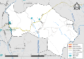
 19104-Lamongerie-Routes-Hydro.png 3,507 × 2,480; 1.4 MB
-
 19104-Lamongerie-Routes-Hydro.svg 1,056 × 744; 2.19 MB
-
 19104-Lamongerie-Sols.png 3,270 × 2,598; 1.5 MB
-
 Lamongerie OSM 01.png 894 × 719; 236 KB
-
 Lamongerie OSM 02.png 894 × 719; 532 KB
-
 Map commune FR insee code 19104.png 756 × 605; 30 KB


