Category:Maps of Landkreis Waldeck-Frankenberg
Jump to navigation
Jump to search
Districts of Hesse:
Urban districts (cities):
Wikimedia category | |||||
| Upload media | |||||
| Instance of | |||||
|---|---|---|---|---|---|
| Category combines topics | |||||
| Waldeck-Frankenberg | |||||
district in Hesse, Germany | |||||
| Instance of | |||||
| Named after | |||||
| Location | Kassel Government Region, Hesse, Germany | ||||
| Capital | |||||
| Head of government |
| ||||
| Inception |
| ||||
| Population |
| ||||
| Area |
| ||||
| Elevation above sea level |
| ||||
| official website | |||||
 | |||||
Subcategories
This category has the following 6 subcategories, out of 6 total.
D
K
- Maps of Kellerwald (9 F)
- Maps of Korbach (3 F)
T
- Maps of Twistetal (1 F)
V
- Maps of Volkmarsen (5 F)
Media in category "Maps of Landkreis Waldeck-Frankenberg"
The following 13 files are in this category, out of 13 total.
-
Einzugsgebietskarte Nuhne.png 4,734 × 3,137; 26.56 MB
-
Einzugsgebietskarte Orke.png 4,973 × 4,196; 38.06 MB
-
Friedhof Bad Arolsen Schmillinghausen.JPG 3,209 × 1,887; 353 KB
-
Friedhof Bad Arolsen Schmillinghausen.png 3,209 × 1,887; 1.45 MB
-
KarteGPZ tn.jpg 434 × 404; 105 KB
-
Hesse kb.png 174 × 245; 7 KB
-
Hessen KB.png 722 × 957; 99 KB
-
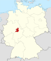
Locator map KB in Germany.svg 1,075 × 1,273; 498 KB
-
Locator map KB in Hesse.svg 868 × 1,164; 655 KB
-
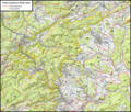
Naturraumkarte Hohe Seite.png 3,338 × 2,849; 17.89 MB
-
Naturraumkarte Medebacher Bucht und Grafschafter Kammer.png 4,763 × 5,810; 51.55 MB
-
Naturraumkarte Ziegenhelle.png 2,706 × 1,958; 9.89 MB
-
Waldeck-Waldek Comit.jpg 981 × 763; 465 KB


