Category:Maps of Liège in the 17th century
Jump to navigation
Jump to search
Media in category "Maps of Liège in the 17th century"
The following 12 files are in this category, out of 12 total.
-
 2014 Liège, Archéoforum (01).jpg 1,624 × 1,071; 1,019 KB
-
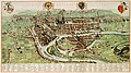
 Atlas de Wit 1698-pl112-Luik (Liège)-KB PPN 145205088.jpg 2,000 × 1,665; 1.52 MB
-
 Atlas Van der Hagen-KW1049B10 077-LEGIA sive LEODIVM vulgo LIEGE.jpeg 5,500 × 3,070; 3.15 MB
-
 De merian Westphaliae 122.jpg 3,959 × 3,096; 3.98 MB
-
 De merian Westphaliae 123.jpg 3,575 × 2,448; 2.71 MB
-
 De Merian-Liège-La Batte.jpg 1,266 × 666; 482 KB
-
 Histoire-de-Guillaume-III-MG 0124.tif 4,644 × 3,531; 46.95 MB
-
 Map liege 1.jpg 1,200 × 800; 182 KB
-
 Map liege 6.jpg 1,200 × 821; 121 KB
-
 Merian-liege3.jpg 966 × 634; 75 KB
-
 Saint-Laurent XVII.jpg 540 × 549; 110 KB
-
 Theatrum Vrbium 00253 Lüttich.jpg 1,231 × 945; 347 KB
.jpg)
-KB_PPN_145205088.jpg)


