Category:Maps of Lieusaint (Seine-et-Marne)
Jump to navigation
Jump to search
Wikimedia category | |||||
| Upload media | |||||
| Instance of | |||||
|---|---|---|---|---|---|
| Category combines topics | |||||
| Lieusaint | |||||
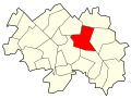
commune in Seine-et-Marne, France  _OSM_01.png) | |||||
| Instance of | |||||
| Location |
| ||||
| Head of government |
| ||||
| Population |
| ||||
| Area |
| ||||
| Different from | |||||
| official website | |||||
 | |||||
Media in category "Maps of Lieusaint (Seine-et-Marne)"
The following 19 files are in this category, out of 19 total.
-
 77251-Lieusaint - Localisation.png 2,500 × 2,480; 1.42 MB
-
 77251-Lieusaint - Relief-PlanIgn.png 7,015 × 4,960; 14.16 MB
-
 77251-Lieusaint-Cadastre.png 7,015 × 4,960; 10.84 MB
-
 77251-Lieusaint-Géologie.png 7,015 × 4,960; 7.48 MB
-
 77251-Lieusaint-Hydro.png 7,015 × 4,960; 9.93 MB
-
 77251-Lieusaint-Natura 2000.png 7,015 × 4,960; 6.32 MB
-
 77251-Lieusaint-Orthophoto.png 7,015 × 4,960; 7.5 MB
-
 77251-Lieusaint-Sols.png 7,015 × 4,960; 6.82 MB
-
 77251-Lieusaint-ZNIEFF1.png 7,015 × 4,960; 6.34 MB
-
 77251-Lieusaint-ZNIEFF2.png 7,015 × 4,960; 6.39 MB
-
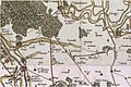 Lieusaint (Seine-et-Marne) - Carte Cassini.jpg 1,120 × 747; 173 KB
-
 Lieusaint (Seine-et-Marne) - Carte hydrographie.png 2,145 × 1,609; 1.42 MB
-
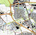
 Lieusaint (Seine-et-Marne) - Carte réseau routier et ferroviaire.png 2,145 × 1,609; 2.13 MB
-
 Lieusaint (Seine-et-Marne) OSM 01.png 639 × 607; 425 KB
-
 Lieusaint (Seine-et-Marne) OSM 02.png 783 × 779; 807 KB
-
 Lieusaint (Seine-et-Marne) OSM 03.png 783 × 779; 573 KB
-
-
 Localisation Lieusaint en Seine-et-Marne, France.svg 1,000 × 1,296; 231 KB
-
 Map commune FR insee code 77251.png 756 × 605; 67 KB


_-_Carte_Cassini.jpg)
_-_Carte_hydrographie.png)
_-_Carte_r%C3%A9seau_routier_et_ferroviaire.png)
_OSM_02.png)
_OSM_03.png)


