Category:Maps of Limpopo municipalities with 2016 borders
Jump to navigation
Jump to search
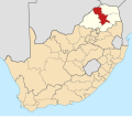
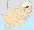
This category contains maps of municipalities in Limpopo province of South Africa that show the the municipal borders as they are after the municipal election of 3 August 2016. This is the most recent demarcation.
Media in category "Maps of Limpopo municipalities with 2016 borders"
The following 37 files are in this category, out of 37 total.
-
Map of Limpopo with districts labelled (2016).svg 925 × 621; 430 KB
-
Map of Limpopo with municipalities blank (2016).svg 925 × 621; 821 KB
-
Map of Limpopo with Ba-Phalaborwa highlighted (2016).svg 925 × 621; 395 KB
-
Map of Limpopo with Bela-Bela highlighted (2016).svg 925 × 621; 387 KB
-
Blank map of Limpopo (2016).svg 850 × 588; 358 KB
-
Map of Limpopo with Blouberg highlighted (2016).svg 925 × 621; 390 KB
-
Map of Limpopo with Capricorn highlighted (2016).svg 925 × 621; 406 KB
-
Map of South Africa with Capricorn highlighted (2016).svg 809 × 709; 696 KB
-
Map of Limpopo with Collins Chabane highlighted (2016).svg 925 × 621; 398 KB
-
Map of Limpopo with Elias Motsoaledi highlighted (2016).svg 925 × 621; 387 KB
-
Map of Limpopo with Ephraim Mogale highlighted (2016).svg 925 × 621; 387 KB
-
Map of Limpopo with Fetakgomo Greater Tubatse highlighted (2016).svg 925 × 621; 391 KB
-
Map of Limpopo with Greater Giyani highlighted (2016).svg 925 × 621; 399 KB
-
Map of Limpopo with Greater Letaba highlighted (2016).svg 925 × 621; 383 KB
-
Map of Limpopo with Greater Tzaneen highlighted (2016).svg 925 × 621; 386 KB
-
Map of Limpopo with Lepelle-Nkumpi highlighted (2016).svg 925 × 621; 391 KB
-
Map of Limpopo with Lephalale highlighted (2016).svg 925 × 621; 414 KB
-
Map of Limpopo with Makhado highlighted (2016).svg 925 × 621; 390 KB
-
Map of Limpopo with Makhuduthamaga highlighted (2016).svg 925 × 621; 387 KB
-
Map of Limpopo with municipalities named and districts shaded (2016).svg 925 × 621; 634 KB
-
Map of Limpopo with Maruleng highlighted (2016).svg 925 × 621; 386 KB
-
Map of Limpopo with Modimolle Mookgophong highlighted (2016).svg 925 × 621; 390 KB
-
Map of Limpopo with Mogalakwena highlighted (2016).svg 925 × 621; 390 KB
-
Map of Limpopo with Molemole highlighted (2016).svg 925 × 621; 385 KB
-
Map of Limpopo with Mopani highlighted (2016).svg 925 × 621; 401 KB
-
Map of South Africa with Mopani highlighted (2016).svg 809 × 709; 694 KB
-
Map of Limpopo with Musina highlighted (2016).svg 925 × 621; 411 KB
-
Map of Limpopo with Polokwane highlighted (2016).svg 925 × 621; 385 KB
-
Map of Limpopo with Sekhukhune highlighted (2016).svg 925 × 621; 398 KB
-
Map of South Africa with Sekhukhune highlighted (2016).svg 809 × 709; 693 KB
-
Map of Limpopo with Thabazimbi highlighted (2016).svg 925 × 621; 403 KB
-
Map of Limpopo with Thulamela highlighted (2016).svg 925 × 621; 395 KB
-
Map of Limpopo with Vhembe highlighted (2016).svg 925 × 621; 413 KB
-
Map of South Africa with Vhembe highlighted (2016).svg 809 × 709; 697 KB
-
Map of Limpopo with Waterberg highlighted (2016).svg 925 × 621; 424 KB
-
Map of South Africa with Waterberg highlighted (2016).svg 809 × 709; 702 KB


