Category:Maps of Loire River in Loir-et-Cher
Jump to navigation
Jump to search
Subcategories
This category has the following 11 subcategories, out of 11 total.
- Maps of Candé-sur-Beuvron (6 F)
- Maps of Chaumont-sur-Loire (8 F)
- Maps of Cour-sur-Loire (5 F)
- Maps of Muides-sur-Loire (6 F)
Media in category "Maps of Loire River in Loir-et-Cher"
The following 9 files are in this category, out of 9 total.
-
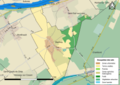
 41069-Cour-sur-Loire-Natura2000-ZPS.png 3,507 × 2,480; 1.02 MB
-
 41129-Maslives-Sols.png 7,015 × 4,960; 3.31 MB
-
 41134-Menars-Sols.png 7,015 × 4,960; 2.97 MB
-
 41207-Saint-Dyé-sur-Loire-Natura2000-SIC.png 3,507 × 2,480; 883 KB
-
 41207-Saint-Dyé-sur-Loire-Natura2000-ZPS.png 3,507 × 2,480; 865 KB
-
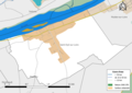
 41207-Saint-Dyé-sur-Loire-Zone inondable.png 3,507 × 2,480; 709 KB
-
 41295-Vineuil-Natura2000-SIC.png 3,507 × 2,480; 2.68 MB
-
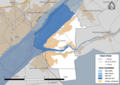 41295-Vineuil-Zone inondable.png 3,507 × 2,480; 1.8 MB
-
 Map commune FR insee code 41207.png 756 × 605; 40 KB


