Category:Maps of Luzillé
Jump to navigation
Jump to search
Wikimedia category | |||||
| Upload media | |||||
| Instance of | |||||
|---|---|---|---|---|---|
| Category combines topics | |||||
| Luzillé | |||||
commune in Indre-et-Loire, France  .svg)  | |||||
| Pronunciation audio | |||||
| Instance of | |||||
| Location |
| ||||
| Street address |
| ||||
| Population |
| ||||
| Area |
| ||||
| official website | |||||
 | |||||
Media in category "Maps of Luzillé"
The following 8 files are in this category, out of 8 total.
-
 37141-Luzillé-argile.png 3,057 × 2,480; 3.13 MB
-
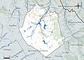
 37141-Luzillé-Cours eau.jpg 3,507 × 2,480; 633 KB
-
 37141-Luzillé-Hydro.jpeg 5,846 × 4,133; 2.18 MB
-
 37141-Luzillé-Sols.png 3,270 × 2,598; 2.39 MB
-
 Luzillé cadastre napoléonien.jpg 891 × 582; 75 KB
-
 Luzillé canton.svg 1,000 × 1,091; 133 KB
-
 Luzillé OSM.jpg 504 × 417; 47 KB
-
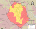
 Map commune FR insee code 37141.png 756 × 605; 75 KB


