Category:Maps of Machault (Seine-et-Marne)
Jump to navigation
Jump to search
Wikimedia category | |||||
| Upload media | |||||
| Instance of | |||||
|---|---|---|---|---|---|
| Category combines topics | |||||
| Machault | |||||
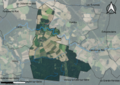
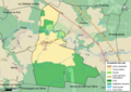
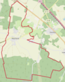
commune in Seine-et-Marne, France .jpg) .svg) _OSM_03.png) | |||||
| Instance of | |||||
| Location |
| ||||
| Head of government |
| ||||
| Population |
| ||||
| Area |
| ||||
| Different from | |||||
| official website | |||||
 | |||||
Subcategories
This category has the following 3 subcategories, out of 3 total.
Media in category "Maps of Machault (Seine-et-Marne)"
The following 10 files are in this category, out of 10 total.
-
 77266-Machault - Localisation.png 2,500 × 2,480; 1.42 MB
-
 77266-Machault - Relief-PlanIgn.png 7,015 × 4,960; 11.29 MB
-
 77266-Machault-Cadastre.png 7,015 × 4,960; 7.56 MB
-
 77266-Machault-Hydro.png 7,015 × 4,960; 4.39 MB
-
 77266-Machault-Orthophoto.png 7,015 × 4,960; 11.07 MB
-
 77266-Machault-Sols.png 7,015 × 4,960; 4.23 MB
-
 Machault (Seine-et-Marne) OSM 01.png 634 × 800; 536 KB
-
 Machault (Seine-et-Marne) OSM 02.png 634 × 800; 782 KB
-
 Machault (Seine-et-Marne) OSM 03.png 1,000 × 952; 1.23 MB
-
 Map commune FR insee code 77266.png 756 × 605; 52 KB


_OSM_01.png)
_OSM_02.png)
