Category:Maps of Montestruc-sur-Gers
Jump to navigation
Jump to search
Wikimedia category | |||||
| Upload media | |||||
| Instance of | |||||
|---|---|---|---|---|---|
| Category combines topics | |||||
| Montestruc-sur-Gers | |||||
commune in Gers, France  .svg)  | |||||
| Instance of | |||||
| Named after | |||||
| Location |
| ||||
| Street address |
| ||||
| Population |
| ||||
| Area |
| ||||
| Elevation above sea level |
| ||||
 | |||||
Media in category "Maps of Montestruc-sur-Gers"
The following 10 files are in this category, out of 10 total.
-
 32286-Montestruc-sur-Gers-argile.jpg 3,057 × 2,480; 420 KB
-
 32286-Montestruc-sur-Gers-Natura2000.png 5,846 × 4,133; 5.8 MB
-
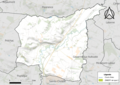
 32286-Montestruc-sur-Gers-Routes-Hydro.png 3,507 × 2,480; 1.62 MB
-
 32286-Montestruc-sur-Gers-Sols.png 3,507 × 2,480; 1.72 MB
-
 32286-Montestruc-sur-Gers-ZNIEFF1.jpg 3,519 × 2,480; 546 KB
-
 32286-Montestruc-sur-Gers-ZNIEFF2.png 3,519 × 2,480; 3.53 MB
-
 Map commune FR insee code 32286.png 756 × 605; 31 KB
-
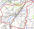
 Montestruc-sur-Gers OSM 01.png 645 × 540; 178 KB
-
 Montestruc-sur-Gers OSM 02.png 426 × 364; 140 KB
-
 Montestruc-sur-Gers OSM 03.png 426 × 364; 61 KB


