Category:Maps of Morogoro Region
Jump to navigation
Jump to search
Media in category "Maps of Morogoro Region"
The following 28 files are in this category, out of 28 total.
-
 Gairo District in Morogoro 2022.svg 857 × 1,005; 509 KB
-
 Gairo District in Morogoro 2023.svg 857 × 1,005; 510 KB
-
 Ifakara Town in Morogoro 2022.svg 857 × 1,005; 509 KB
-
 Ifakara Town in Morogoro 2023.svg 857 × 1,005; 510 KB
-
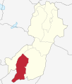
 Kilombero District in Morogoro 2022.svg 857 × 1,005; 509 KB
-
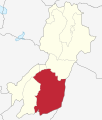
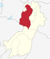 Kilosa District in Morogoro 2022.svg 857 × 1,005; 509 KB
-
 Kilosa District in Morogoro 2023.svg 857 × 1,005; 510 KB
-
 Kimamba.png 1,946 × 1,565; 592 KB
-
 Malinyi District in Morogoro 2022.svg 857 × 1,005; 509 KB
-
 Malinyi District in Morogoro 2023.svg 857 × 1,005; 510 KB
-
 Mlimba District in Morogoro 2023.svg 857 × 1,005; 510 KB
-
 Morogoro District in Morogoro 2022.svg 857 × 1,005; 509 KB
-
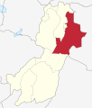 Morogoro District in Morogoro 2023.svg 857 × 1,005; 510 KB
-
 Morogoro Municipal in Morogoro 2022.svg 857 × 1,005; 509 KB
-
 Morogoro Municipal in Morogoro 2023.svg 857 × 1,005; 510 KB
-
 Mvomero District in Morogoro 2022.svg 857 × 1,005; 509 KB
-
 Mvomero District in Morogoro 2023.svg 857 × 1,005; 510 KB
-
 Tanzania Kilombero location map.svg 135 × 120; 1.46 MB
-
 Tanzania Kilosa location map.svg 135 × 120; 1.46 MB
-
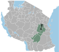
 Tanzania Morogoro location map.svg 3,302 × 3,143; 1.04 MB
-
 Tanzania Morogoro location map2.svg 135 × 120; 1.46 MB
-
 Tanzania Morogoro Mjini location map.svg 135 × 120; 1.46 MB
-
 Tanzania Morogoro Vijijini location map.svg 135 × 120; 1.46 MB
-
 Tanzania Morogoro.png 536 × 546; 11 KB
-
 Tanzania Mvomero location map.svg 135 × 120; 1.46 MB
-
 Tanzania Ulanga location map.svg 135 × 120; 1.46 MB
-
 Ulanga District in Morogoro 2022.svg 857 × 1,005; 509 KB
-
 Ulanga District in Morogoro 2023.svg 857 × 1,005; 510 KB


