Category:Maps of Newfoundland and Labrador provincial electoral districts
Jump to navigation
Jump to search
Media in category "Maps of Newfoundland and Labrador provincial electoral districts"
The following 35 files are in this category, out of 35 total.
-
 Baie Verte-Green Bay electoral district map.svg 545 × 620; 680 KB
-
 Bonavista electoral district map.svg 545 × 620; 680 KB
-
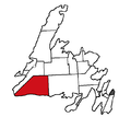
 Burgeo-La Poile electoral district map.svg 545 × 620; 680 KB
-
 Burgeo-La Poile.png 661 × 591; 18 KB
-
 Burin-Grand Bank electoral district map.svg 545 × 620; 680 KB
-
 Corner Brook electoral district map.svg 545 × 620; 680 KB
-
 Exploits electoral district map.svg 545 × 620; 680 KB
-
 Fogo Island-Cape Freels electoral district map.svg 545 × 620; 680 KB
-
 Fortune Bay-Cape La Hune electoral district map.svg 545 × 620; 680 KB
-
 Gander electoral district map.svg 545 × 620; 680 KB
-
 Grand Falls-Windsor-Buchans electoral district map.svg 545 × 620; 680 KB
-
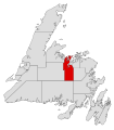
 Harbour Grace-Port de Grave electoral district map.svg 545 × 620; 680 KB
-
 Humber-Bay of Islands electoral district map.svg 545 × 620; 680 KB
-
 Humber-Gros Morne electoral district map.svg 545 × 620; 680 KB
-
 Lewisporte-Twillingate electoral district map.svg 545 × 620; 680 KB
-
 Newfoundland 2015 Cape St. Francis.svg 366 × 495; 3.57 MB
-
 Newfoundland 2015 Conception Bay East - Bell Island.svg 366 × 495; 3.53 MB
-
 Newfoundland 2015 Conception Bay South.svg 366 × 495; 3.45 MB
-
 Newfoundland 2015 Corner Brook.svg 119 × 136; 353 KB
-
 Newfoundland 2015 Mount Pearl - Southlands.svg 366 × 495; 3.41 MB
-
 Newfoundland 2015 Mount Pearl North.svg 366 × 495; 3.41 MB
-
 Newfoundland 2015 Mount Scio.svg 366 × 495; 3.44 MB
-
 Newfoundland 2015 St. John's Centre.svg 366 × 495; 3.4 MB
-
 Newfoundland 2015 St. John's East - Quidi Vidi.svg 366 × 495; 3.42 MB
-
 Newfoundland 2015 St. John's West.svg 366 × 495; 3.41 MB
-
 Newfoundland 2015 Topsail - Paradise.svg 366 × 495; 3.42 MB
-
 Newfoundland 2015 Virginia Waters - Pleasantville.svg 366 × 495; 3.42 MB
-
 Newfoundland 2015 Waterford Valley.svg 366 × 495; 3.47 MB
-
 Newfoundland 2015 Windsor Lake.svg 366 × 495; 3.42 MB
-
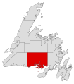
 Placentia West-Bellevue electoral district map.svg 545 × 620; 680 KB
-
 St. Barbe-L'Anse aux Meadows electoral district map.svg 545 × 620; 680 KB
-
 St. George's-Humber electoral district map.svg 545 × 620; 680 KB
-
 Stephenville-Port au Port electoral district map.svg 545 × 620; 680 KB
-
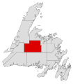
 Terra Nova electoral district map.svg 545 × 620; 680 KB
-
 Trinity-Bay de Verde.png 478 × 523; 17 KB


