Category:Maps of Nottingham
Jump to navigation
Jump to search
Wikimedia category | |||||
| Upload media | |||||
| Instance of | |||||
|---|---|---|---|---|---|
| Category combines topics | |||||
| Nottingham | |||||
city in Nottinghamshire, England    | |||||
| Instance of |
| ||||
| Location | City of Nottingham, Nottinghamshire, East Midlands, England | ||||
| Legislative body | |||||
| Official language | |||||
| Inception |
| ||||
| Population |
| ||||
| Area |
| ||||
| Elevation above sea level |
| ||||
| Different from | |||||
| official website | |||||
 | |||||
Media in category "Maps of Nottingham"
The following 47 files are in this category, out of 47 total.
-
 30 of '(Our own country. Descriptive, historical, pictorial.)' (11181471993).jpg 1,963 × 1,648; 1.04 MB
-
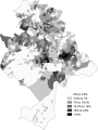
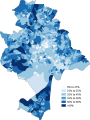
 African Nottingham 2011 census.png 13,257 × 17,608; 8.56 MB
-
 Arab Nottingham 2011 census.png 13,213 × 17,549; 8.45 MB
-
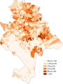
 Asian Nottingham 2011 census.png 13,170 × 17,492; 8.48 MB
-
 Bangladeshi Nottingham 2011 census.png 13,170 × 17,492; 8.47 MB
-
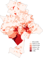
 Black Nottingham 2011 census.png 13,213 × 17,550; 8.11 MB
-
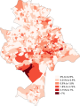
 British Nottingham 2011 census.png 13,126 × 17,434; 8.03 MB
-
 Buddhism Nottingham 2011 census.png 13,170 × 17,492; 8.62 MB
-
 Caribbean Nottingham 2011 census.png 13,213 × 17,550; 8.55 MB
-
 Chinese Nottingham 2011 census.png 13,213 × 17,549; 8.53 MB
-
 Christianity Nottingham 2011 census.png 13,213 × 17,550; 8.52 MB
-
 Clifton-wards.png 1,870 × 2,799; 3.8 MB
-
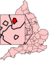 EnglandNottingham.png 200 × 247; 28 KB
-
 Greater Nottingham Map.jpg 338 × 338; 116 KB
-
 GreaterNottingham-map.png 2,443 × 1,600; 3.16 MB
-
 Hinduism Nottingham 2011 census.png 13,257 × 17,608; 8.57 MB
-
 Indian Nottingham 2011 census.png 13,170 × 17,492; 8.54 MB
-
 Location map United Kingdom Nottingham Central.png 543 × 545; 645 KB
-
 Nott-BUA-2011.jpg 989 × 700; 746 KB
-
 Nottingham - Nottinghamshire dot.png 1,802 × 2,589; 189 KB
-
 Nottingham built-up area map.jpg 1,443 × 1,116; 569 KB
-
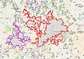
 Nottingham city boundary map overlay.svg 500 × 640; 3 KB
-
 Nottingham Map 1831 by Staveley and Wood.jpg 6,850 × 7,087; 6.79 MB
-
 Nottingham UK location map.svg 1,003 × 1,306; 256 KB
-
 Nottingham UK locator map.svg 1,030 × 1,305; 906 KB
-
 Nottingham UK ward map (2007 results).svg 1,003 × 1,306; 267 KB
-
 Nottingham UK ward map (2011 results).svg 1,003 × 1,306; 260 KB
-
 Nottingham UK ward map (2015 results).svg 1,003 × 1,306; 259 KB
-
 Nottingham UK ward map 2010 (blank).svg 1,003 × 1,306; 223 KB
-
 Nottingham Whitefriars.jpg 500 × 808; 69 KB
-
 Nottingham-Derby-BUA-2011.jpg 989 × 700; 754 KB
-
 Nottingham-Derby-Mansfield-Alfreton-Belper-Heage-Crich-BUA-2011.jpg 952 × 952; 988 KB
-
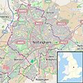
 Nottinghamshire Nottingham.png 957 × 1,217; 121 KB
-
 NottinghamUrbanArea.svg 895 × 687; 77 KB
-
 Ordnance Survey 1 inch Nottingham 1947.jpg 2,550 × 3,600; 7.95 MB
-
 Ordnance Survey One-Inch Sheet 112 Nottingham, Published 1947.jpg 10,875 × 12,765; 15.9 MB
-
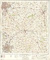
 Ordnance Survey One-Inch Sheet 112 Nottingham, Published 1960.jpg 8,289 × 9,973; 11.75 MB
-
 Ordnance Survey One-Inch Sheet 112 Nottingham, Published 1968.jpg 8,327 × 9,898; 11.61 MB
-
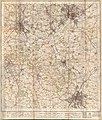
 Ordnance Survey One-Inch Sheet 121 Derby & Leicester, Published 1962 2.jpg 8,622 × 10,685; 19.98 MB
-
 Ordnance Survey One-Inch Sheet 121 Derby & Leicester, Published 1962.jpg 8,288 × 9,900; 11.78 MB
-
 Ordnance Survey One-Inch Sheet 121 Derby Nottingham and Leicester, Published 1946.jpg 10,891 × 12,823; 16.04 MB
-
 Ordnance Survey One-Inch Sheet 122 Melton Mowbray, Published 1947.jpg 10,858 × 12,737; 15.22 MB
-
 Ordnance Survey One-Inch Sheet 122 Melton Mowbray, Published 1962.jpg 8,294 × 9,920; 11.13 MB
-
 Ordnance Survey Quarter-inch sheet 13 The Midlands, published 1962.jpg 9,697 × 8,913; 13.67 MB
-
 Ordnance Survey Quarter-inch sheet 13 The Midlands, published 1965.jpg 9,704 × 8,949; 12.89 MB
-
 SneintonCricketClubandGround1920.png 346 × 441; 273 KB
-
 Talbot Street electricity power station, Nottingham.png 838 × 454; 783 KB
%27_(11181471993).jpg)


.svg)
.svg)
.svg)


.svg)