Category:Maps of Odisha
Jump to navigation
Jump to search
States of India: Andhra Pradesh · Arunachal Pradesh · Assam · Bihar · Chhattisgarh · Goa · Gujarat · Haryana · Himachal Pradesh · Jharkhand · Karnataka · Kerala · Madhya Pradesh · Maharashtra · Manipur · Meghalaya · Mizoram · Nagaland · Odisha · Punjab · Rajasthan · Sikkim · Tamil Nadu · Telangana · Tripura · Uttar Pradesh · Uttarakhand · West Bengal
Union territories: Andaman and Nicobar Islands · Chandigarh · Dadra and Nagar Haveli and Daman and Diu · Delhi · Jammu and Kashmir · Ladakh · Lakshadweep · Puducherry
Former states of India: Jammu and Kashmir ·
Former union territories: Dadra and Nagar Haveli district · Daman and Diu ·
Union territories: Andaman and Nicobar Islands · Chandigarh · Dadra and Nagar Haveli and Daman and Diu · Delhi · Jammu and Kashmir · Ladakh · Lakshadweep · Puducherry
Former states of India: Jammu and Kashmir ·
Former union territories: Dadra and Nagar Haveli district · Daman and Diu ·
Wikimedia category | |||||
| Upload media | |||||
| Instance of | |||||
|---|---|---|---|---|---|
| Category combines topics | |||||
| Odisha | |||||
state in Eastern India | |||||
| Pronunciation audio | |||||
| Instance of | |||||
| Location | India | ||||
| Capital | |||||
| Legislative body | |||||
| Official language | |||||
| Head of state | |||||
| Head of government |
| ||||
| Inception |
| ||||
| Population |
| ||||
| Area |
| ||||
| Different from | |||||
| official website | |||||
 | |||||
Subcategories
This category has the following 12 subcategories, out of 12 total.
Media in category "Maps of Odisha"
The following 37 files are in this category, out of 37 total.
-
Baghamari Layout.JPG 400 × 400; 22 KB
-
Capital of Mayurbhanj state.png 3,264 × 2,445; 2.43 MB
-
Chilika lake.png 958 × 717; 1.97 MB
-
Cuttack City Police area map.jpg 1,400 × 2,000; 173 KB
-
Dhamnagar Map.png 2,020 × 1,738; 439 KB
-
Distribution of Scheduled Tribes of Odisha.svg 822 × 627; 657 KB
-
Forts map of the Khurda kingdom.png 1,000 × 641; 121 KB
-
Gosani Block Map.jpg 659 × 910; 211 KB
-
Gumma Block Map.jpg 594 × 685; 239 KB
-
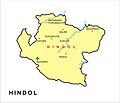
HINDOL MAP.jpg 1,235 × 1,064; 103 KB
-
India Odisha relief map.svg 1,128 × 860; 1.76 MB
-
Kapilendra Dev.jpg 800 × 1,100; 648 KB
-
Kashinagar Block Map.jpg 720 × 821; 195 KB
-
Kendrapara.jpg 307 × 222; 9 KB
-
Khurda kingdom map.png 658 × 539; 151 KB
-
Language Families of Odisha.svg 512 × 362; 899 KB
-
Location Map of Karlapt Wildlife Sanctuary, Odisha, India.jpg 1,149 × 675; 64 KB
-
Map of 5th Schedule Areas of Orissa.jpg 865 × 604; 81 KB
-
Map-orissa-admin-1991.jpg 895 × 847; 69 KB
-
Mayurbhanj district's language distribution map.gif 1,920 × 1,646; 2.71 MB
-
Mohana Block Map.jpg 614 × 638; 245 KB
-
Mohana Legislative Assembly Constituency.jpg 505 × 720; 194 KB
-
Mu Krushaka.png 225 × 225; 72 KB
-
Nayagaon sonepur constituency.png 1,204 × 502; 360 KB
-
Nuagada Block Map.png 1,311 × 1,600; 1.11 MB
-
Odisha Map Subdivision.jpg 512 × 470; 162 KB
-
Odisha outline shape.svg 300 × 300; 131 KB
-
Odisha Wikivoyage map.png 3,047 × 2,323; 1.29 MB
-
Padhanpada.png 493 × 496; 28 KB
-
Paralakhemundi Legislative Assembly Constituency.jpg 602 × 667; 131 KB
-
Pattamundai Block Map.png 754 × 517; 63 KB
-
Percentage of Scheduled Tribes (district wise) - Odisha.svg 822 × 627; 646 KB
-
R.Udayagiri Block Map.jpg 607 × 701; 230 KB
-
Rayagada Block Map.png 1,363 × 1,319; 1.1 MB
-
Spg05 plan.jpg 1,442 × 1,909; 386 KB
-
St distribution of Odisha.jpg 538 × 415; 50 KB
-
Tourist map signboard of North division Similipal WLS.jpg 2,048 × 1,489; 1.95 MB


