Category:Maps of Ogden, Utah
Jump to navigation
Jump to search
Wikimedia category | |||||
| Upload media | |||||
| Instance of | |||||
|---|---|---|---|---|---|
| Category combines topics | |||||
| Ogden | |||||
city in and county seat of Weber County, Utah, United States    | |||||
| Instance of | |||||
| Named after | |||||
| Location | Weber County, Utah | ||||
| Located in or next to body of water | |||||
| Head of government |
| ||||
| Inception |
| ||||
| Population |
| ||||
| Area |
| ||||
| Elevation above sea level |
| ||||
| official website | |||||
 | |||||
Subcategories
This category has only the following subcategory.
S
Media in category "Maps of Ogden, Utah"
The following 17 files are in this category, out of 17 total.
-
 UTMap-doton-Ogden.PNG 238 × 300; 19 KB
-
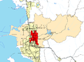 CtyMapWeber.png 936 × 689; 43 KB
-

-

-
 Birds eye view of Ogden City, Utah, Ty. 1875. LOC 75696608.jpg 7,144 × 5,352; 8.75 MB
-
 Birds eye view of Ogden City, Utah, Ty. 1875. LOC 75696608.tif 7,144 × 5,352; 109.39 MB
-
 Map of Ogden City, Utah - DPLA - 0994001c786e059b1e505c5cb0f774e9.jpg 7,370 × 8,999; 6.36 MB
-
 Map of Ogden City, Utah Ty. - DPLA - e1027729bc63006bbcb8825db510ee00.jpg 5,730 × 8,999; 6.69 MB
-
 Old Weber College campus map.jpg 2,592 × 1,944; 2.41 MB
-
 Perspective map of Ogden, Utah 1890. LOC 75696610.jpg 11,375 × 7,474; 18.24 MB
-
 Perspective map of Ogden, Utah 1890. LOC 75696610.tif 11,375 × 7,474; 243.24 MB
-
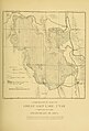 Plate 33 Comparative Map of Great Salt Lake.jpg 1,338 × 1,973; 406 KB
-
 Sanborn 1890 Ogden Military Academy.jpg 1,024 × 640; 294 KB
-
 View of Ogden City, Utah Territory. LOC 75696609.jpg 11,566 × 6,954; 15.94 MB
-
 WCNF Wilderness Map.jpg 700 × 513; 91 KB
-
-
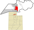
 Webercounty ut.png 900 × 402; 18 KB


