Category:Maps of Onstwedde
Jump to navigation
Jump to search
Wikimedia category | |||||
| Upload media | |||||
| Instance of | |||||
|---|---|---|---|---|---|
| Category combines topics |
| ||||
| Onstwedde | |||||
former municipality in the province of Groningen, the Netherlands  | |||||
| Instance of |
| ||||
| Location |
| ||||
| Dissolved, abolished or demolished date |
| ||||
| Population |
| ||||
| Replaced by | |||||
| |||||
Media in category "Maps of Onstwedde"
The following 3 files are in this category, out of 3 total.
-
 Map - NL - Stadskanaal - Wijk 03 Onstwedde.svg 625 × 575; 11 KB
-
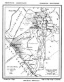 Onstwedde gemeenteatlas Kuyper.tif 1,918 × 2,448; 576 KB
-
 Plattegrond - Onstwedde - 20173504 - RCE.jpg 955 × 1,200; 273 KB

