Category:Maps of Oxford
Jump to navigation
Jump to search
Wikimedia category | |||||
| Upload media | |||||
| Instance of | |||||
|---|---|---|---|---|---|
| Category combines topics | |||||
| Oxford | |||||
city in Oxfordshire, England       | |||||
| Pronunciation audio | |||||
| Instance of |
| ||||
| Patron saint | |||||
| Location | Oxford, Oxfordshire, South East England, England | ||||
| Located in or next to body of water | |||||
| Inception |
| ||||
| Significant event |
| ||||
| Population |
| ||||
| Area |
| ||||
| Different from | |||||
| official website | |||||
 | |||||
Media in category "Maps of Oxford"
The following 30 files are in this category, out of 30 total.
-
 Bodleian Libraries, Oksford.jpg 765 × 1,000; 96 KB
-
 A4144 Road United Kingdom.png 250 × 250; 24 KB
-
 David Loggan - Oxonia Illustrata, 1675 - Map of Oxford (BL 128.h.10)-detail.jpg 1,262 × 1,036; 472 KB
-
 ENG Oxford Cheney Lane 08.jpg 4,032 × 3,024; 843 KB
-
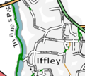 IffleyVillageMap.png 504 × 454; 128 KB
-
 Location Map Oxford UK.png 1,073 × 982; 1.1 MB
-
 Location map United Kingdom Oxford Central.png 2,556 × 1,540; 2.8 MB
-
 Location of The Four Candles, 51 George Street, Oxford OX1 2BE.jpg 1,059 × 583; 373 KB
-
 Location of The Swan and Castle, Castle Street, Oxford OX1 1AY.PNG 1,086 × 764; 403 KB
-
 Magdalen College Oxford campus map.svg 5,368 × 4,954; 581 KB
-
 Map at the council office - geograph.org.uk - 1392712.jpg 640 × 480; 113 KB
-
 Map of Oxford Town Hall.jpg 8,160 × 6,120; 11.28 MB
-
 Marston Cycle Path.png 3,192 × 1,675; 3.7 MB
-
 Merton-college-buildings-historical-map.png 4,153 × 3,484; 663 KB
-
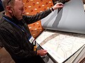 Museum of Oxford volunteer with maps.jpg 8,160 × 6,120; 8.98 MB
-
 Old Navigation stream by Lighthouse.jpg 602 × 764; 57 KB
-
 Ordnance Survey Sheet SP 50 Oxford (east), Published 1960.jpg 7,378 × 7,521; 18.81 MB
-
 OX-postcode area.png 256 × 256; 16 KB
-
 Oxford - Oxfordshire dot.png 1,802 × 2,589; 189 KB
-
 Oxford Green Belt.svg 1,600 × 1,589; 2.49 MB
-
 Oxford in the UK.png 324 × 489; 40 KB
-
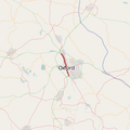
 Oxford map small.png 360 × 370; 156 KB
-
 Oxford map small.svg 360 × 370; 204 KB
-
 Oxford UK locator map.svg 1,077 × 1,266; 921 KB
-
 Oxford unparished area UK locator map.svg 990 × 1,266; 143 KB
-
 OxfordEast2007Constituency.svg 214 × 280; 128 KB
-
 OxfordEastConstituency.svg 200 × 250; 41 KB
-
 OxfordWestAbingdon2007Constituency.svg 214 × 280; 128 KB
-
 OxfordWestAbingdonConstituency.svg 200 × 250; 41 KB
-
 RoseHillMap.png 619 × 588; 250 KB


-detail.jpg)


,_Published_1960.jpg)


