Category:Maps of Port-la-Nouvelle
Jump to navigation
Jump to search
Wikimedia category | |||||
| Upload media | |||||
| Instance of | |||||
|---|---|---|---|---|---|
| Category combines topics | |||||
| Port-la-Nouvelle | |||||
commune in Aude, France   | |||||
| Instance of | |||||
| Location |
| ||||
| Population |
| ||||
| Area |
| ||||
| Elevation above sea level |
| ||||
| official website | |||||
 | |||||
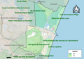
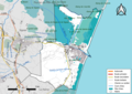
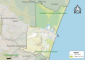
Media in category "Maps of Port-la-Nouvelle"
The following 10 files are in this category, out of 10 total.
-
 11-AAV2020Port-la-Nouvelle.png 3,519 × 2,930; 2.14 MB
-
 11-Port-la-Nouvelle-AAV2020.png 3,519 × 2,930; 351 KB
-
 11266-Port-la-Nouvelle-argile.jpg 3,057 × 2,480; 597 KB
-
 11266-Port-la-Nouvelle-Natura2000.png 4,677 × 3,307; 7.09 MB
-
 11266-Port-la-Nouvelle-Routes-Hydro.png 3,507 × 2,480; 2.45 MB
-
 11266-Port-la-Nouvelle-Sols.png 3,270 × 2,598; 2.04 MB
-
 11266-Port-la-Nouvelle-ZNIEFF1.png 3,057 × 2,480; 4.52 MB
-
 11266-Port-la-Nouvelle-ZNIEFF2.png 3,519 × 2,480; 5.05 MB
-
 Map commune FR insee code 11266.png 756 × 605; 77 KB
-
 Périmètre RNR Sainte-Lucie rnr202.png 1,198 × 887; 400 KB


