Category:Maps of Pula
Jump to navigation
Jump to search
Subcategories
This category has the following 2 subcategories, out of 2 total.
O
- Old maps of Pula (10 F)
S
- Scale model of Pula, Croatia (18 F)
Media in category "Maps of Pula"
The following 11 files are in this category, out of 11 total.
-
-
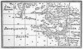
 Карта-схема к статье «Пола». Военная энциклопедия Сытина (Санкт-Петербург, 1911-1915).jpg 2,793 × 2,066; 1.66 MB
-
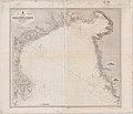 Admiralty Chart No 201 Adriatic Sheet 1 Gulfs of Venice and Trieste, Published 1879.jpg 12,500 × 10,741; 14.11 MB
-
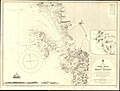 Admiralty Chart No 202 Port Pola and the Brioni Islands, Published 1872, New Edition 1914.jpg 11,044 × 8,376; 30.63 MB
-
 Brioni Grande 1912.jpg 650 × 548; 118 KB
-
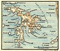
 Confini Trieste-Istria2.jpg 1,471 × 2,130; 371 KB
-
 LagPula.png 330 × 355; 21 KB
-
 Lokace-Pula.jpg 201 × 199; 9 KB
-
 Pula BV044704957.jpg 1,992 × 968; 655 KB
-
 Pula city map.GIF 469 × 542; 6 KB
-
 Tabula Peutingeriana - Istra.JPG 839 × 307; 86 KB
.jpg)
.jpg)


