Category:Maps of Quebec provincial electoral districts
Jump to navigation
Jump to search
Media in category "Maps of Quebec provincial electoral districts"
The following 60 files are in this category, out of 60 total.
-
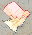
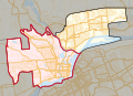
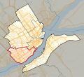
 39e législature du Québec - Montréal et Laval - Laval-des-Rapides.svg 4,806 × 3,195; 509 KB
-
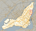
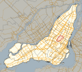
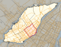
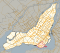
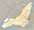
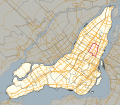
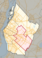
 Circonscription électorale Taschereau.png 2,732 × 2,067; 933 KB
-
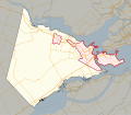
 Jonquiere-Alma.png 559 × 627; 24 KB
-
 Laurier-Dorion2.jpg 453 × 540; 26 KB
-
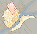
 Quebec 2011 Acadie.svg 677 × 588; 20.39 MB
-
 Quebec 2011 Anjou-Louis-Riel.svg 677 × 588; 20.41 MB
-
 Quebec 2011 Blainville.svg 170 × 186; 4.49 MB
-
 Quebec 2011 Bourassa-Sauvé.svg 677 × 588; 20.38 MB
-
 Quebec 2011 Bourget.svg 677 × 588; 20.4 MB
-
 Quebec 2011 Chapleau.svg 209 × 152; 4.37 MB
-
 Quebec 2011 Charlesbourg.svg 332 × 304; 7.07 MB
-
 Quebec 2011 Chicoutimi.svg 238 × 142; 5.12 MB
-
 Quebec 2011 Chomedey.svg 346 × 265; 13.05 MB
-
 Quebec 2011 Châteauguay.svg 148 × 151; 1.13 MB
-
 Quebec 2011 D'Arcy-McGee.svg 677 × 588; 20.41 MB
-
 Quebec 2011 Fabre.svg 346 × 265; 13.07 MB
-
 Quebec 2011 Gouin.svg 677 × 588; 20.4 MB
-
 Quebec 2011 Groulx.svg 170 × 186; 4.52 MB
-
 Quebec 2011 Hochelaga-Maisonneuve.svg 677 × 588; 20.38 MB
-
 Quebec 2011 Hull.svg 209 × 152; 4.38 MB
-
 Quebec 2011 Jacques-Cartier.svg 677 × 588; 20.44 MB
-
 Quebec 2011 Jean-Lesage.svg 332 × 304; 7.08 MB
-
 Quebec 2011 Jean-Talon.svg 332 × 304; 7.08 MB
-
 Quebec 2011 Jeanne-Mance-Viger.svg 677 × 588; 20.41 MB
-
 Quebec 2011 Jonquière.svg 238 × 142; 5.12 MB
-
 Quebec 2011 L'Assomption.svg 178 × 203; 4.95 MB
-
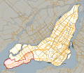
 Quebec 2011 La Pinière.svg 224 × 314; 8.64 MB
-
 Quebec 2011 LaFontaine.svg 677 × 588; 20.4 MB
-
 Quebec 2011 Laporte.svg 224 × 314; 8.64 MB
-
 Quebec 2011 Laurier-Dorion.svg 677 × 588; 20.39 MB
-
 Quebec 2011 Laval-des-Rapides.svg 346 × 265; 13.04 MB
-
 Quebec 2011 Lévis.svg 332 × 304; 7.09 MB
-
 Quebec 2011 Marguerite-Bourgeoys.svg 677 × 588; 20.4 MB
-
 Quebec 2011 Marie-Victorin.svg 224 × 314; 8.64 MB
-
 Quebec 2011 Marquette.svg 677 × 588; 20.43 MB
-
 Quebec 2011 Maurice-Richard.svg 677 × 588; 20.39 MB
-
 Quebec 2011 Mercier.svg 677 × 588; 20.39 MB
-
 Quebec 2011 Mille-Îles.svg 346 × 265; 13.08 MB
-
 Quebec 2011 Mont-Royal-Outremont.svg 677 × 588; 20.41 MB
-
 Quebec 2011 Montarville.svg 224 × 314; 8.68 MB
-
 Quebec 2011 Nelligan.svg 677 × 588; 20.45 MB
-
 Quebec 2011 Notre-Dame-de-Grâce.svg 677 × 588; 20.42 MB
-
 Quebec 2011 Pointe-aux-Trembles.svg 677 × 588; 20.41 MB
-
 Quebec 2011 Repentigny.svg 178 × 203; 4.96 MB
-
 Quebec 2011 Robert-Baldwin.svg 677 × 588; 20.4 MB
-
 Quebec 2011 Rosemont.svg 677 × 588; 20.39 MB
-
 Quebec 2011 Saint-Henri-Sainte-Anne.svg 677 × 588; 20.42 MB
-
 Quebec 2011 Saint-Laurent.svg 677 × 588; 20.42 MB
-
 Quebec 2011 Sainte-Marie-Saint-Jacques.svg 677 × 588; 20.4 MB
-
 Quebec 2011 Sainte-Rose.svg 346 × 265; 13.06 MB
-
 Quebec 2011 Soulanges.svg 201 × 175; 10.14 MB
-
 Quebec 2011 Taillon.svg 224 × 314; 8.64 MB
-
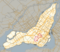
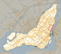
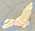
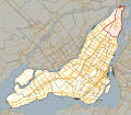
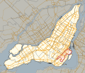
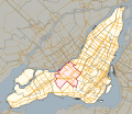
 Quebec 2011 Taschereau.svg 332 × 304; 7.08 MB
-
 Quebec 2011 Vachon.svg 224 × 314; 8.64 MB
-
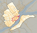
 Quebec 2011 Vanier-Les Rivières.svg 332 × 304; 7.1 MB
-
 Quebec 2011 Vaudreuil.svg 201 × 175; 10.09 MB
-
 Quebec 2011 Verdun.svg 677 × 588; 20.4 MB
-
 Quebec 2011 Viau.svg 677 × 588; 20.39 MB
-
 Quebec 2011 Vimont.svg 346 × 265; 13.06 MB
-
 Quebec 2011 Westmount-Saint-Louis.svg 677 × 588; 20.4 MB


