Category:Maps of Ratzeburg prince-bishopric
Jump to navigation
Jump to search
Media in category "Maps of Ratzeburg prince-bishopric"
The following 8 files are in this category, out of 8 total.
-
 Bishopric of Ratzeburg locator map (1250).svg 990 × 780; 3.14 MB
-
 Karte-Mecklenburg 1300.png 1,200 × 880; 531 KB
-
 Grafschaften Holstein Ratzeburg Schwerin Dannenberg Luechow 1250.png 700 × 796; 284 KB
-
 Grafschaften Holstein Ratzeburg Schwerin Dannenberg Luechow 1250.svg 700 × 794; 1.66 MB
-
 Herzogtum Sachsen Lauenburg 1400.PNG 349 × 343; 88 KB
-
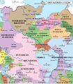 Północno-wschodnie Niemcy ok 1250-es.svg 1,759 × 2,000; 1.48 MB
-
 Północno-wschodnie Niemcy ok 1250.svg 700 × 796; 1.7 MB
-
 Reilly 302.jpg 1,132 × 902; 417 KB
.svg)


