Category:Maps of Restinclières
Jump to navigation
Jump to search
Wikimedia category | |||||
| Upload media | |||||
| Instance of | |||||
|---|---|---|---|---|---|
| Category combines topics | |||||
| Restinclières | |||||
commune in Hérault, France  .svg) _-_2021-07-09_-_1.jpg)  | |||||
| Instance of | |||||
| Location | |||||
| Street address |
| ||||
| Head of government |
| ||||
| Population |
| ||||
| Area |
| ||||
| Elevation above sea level |
| ||||
| official website | |||||
 | |||||
Media in category "Maps of Restinclières"
The following 10 files are in this category, out of 10 total.
-
 34227-Restinclières-argile.jpg 3,057 × 2,480; 489 KB
-
 34227-Restinclières-Natura2000b.png 7,015 × 4,960; 10.88 MB
-
 34227-Restinclières-Routes-Hydro.png 3,507 × 2,480; 2.78 MB
-
 34227-Restinclières-Sols.png 3,270 × 2,598; 2.32 MB
-
 34227-Restinclières-ZNIEFF1.png 3,519 × 2,480; 4.99 MB
-
 34227-Restinclières-ZNIEFF2.png 3,519 × 2,480; 5.05 MB
-
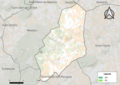
 Map commune FR insee code 34227.png 756 × 605; 39 KB
-
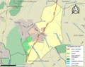
 Restinclières OSM 01.png 655 × 637; 305 KB
-
 Restinclières OSM 02.png 396 × 596; 190 KB
-
 Restinclières OSM 03.png 396 × 596; 138 KB


