Category:Maps of Rillé
Jump to navigation
Jump to search
Wikimedia category | |||||
| Upload media | |||||
| Instance of | |||||
|---|---|---|---|---|---|
| Category combines topics | |||||
| Rillé | |||||
commune in Indre-et-Loire, France   | |||||
| Pronunciation audio | |||||
| Instance of | |||||
| Location |
| ||||
| Street address |
| ||||
| Population |
| ||||
| Area |
| ||||
| official website | |||||
 | |||||
Media in category "Maps of Rillé"
The following 7 files are in this category, out of 7 total.
-
 37198-Rillé-argile.png 3,057 × 2,480; 1.91 MB
-
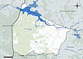
 37198-Rillé-Cours eau.jpg 3,507 × 2,480; 449 KB
-
 37198-Rillé-Hydro.jpeg 5,846 × 4,133; 1.64 MB
-
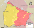
 37198-Rillé-Sols.png 3,270 × 2,598; 1.51 MB
-
 Briche ferme 1867.svg 560 × 434; 98 KB
-
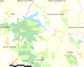 Map commune FR insee code 37198.png 756 × 605; 57 KB
-
 Rillé Cassini.JPG 898 × 591; 125 KB


