Category:Maps of River Tay
Jump to navigation
Jump to search
Media in category "Maps of River Tay"
The following 12 files are in this category, out of 12 total.
-
 Admiralty Chart No 1481 River Tay, Published 1960.jpg 9,889 × 6,785; 26.12 MB
-

-

-
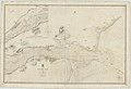 Admiralty Chart No 1481 River Tay, Published 1843.jpg 9,895 × 6,781; 18.84 MB
-

-

-
 Ordnance Survey One-Inch Sheet 55 Perth & Alloa, Published 1957.jpg 8,321 × 9,985; 11.21 MB
-
 Ordnance Survey One-Inch Sheet 55 Perth & Alloa, Published 1969.jpg 8,421 × 10,004; 33.75 MB
-
 Ordnance Survey Quarter-inch sheet 3 The Forth, Clyde & Tay, published 1946.jpg 13,238 × 10,969; 16.2 MB
-
 Tay.catchment.jpg 1,196 × 765; 198 KB
-
 Tay.catchment.Scotland.jpg 826 × 1,307; 204 KB
-
 Tay.tributaries.jpg 1,600 × 1,024; 256 KB

.jpg)
%27_(11297735906).jpg)

.png)
.jpg)


