Category:Maps of Saint-Georges-de-Longuepierre
Jump to navigation
Jump to search
Wikimedia category | |||||
| Upload media | |||||
| Instance of | |||||
|---|---|---|---|---|---|
| Category combines topics | |||||
| Saint-Georges-de-Longuepierre | |||||
commune in Charente-Maritime, France   | |||||
| Instance of | |||||
| Location |
| ||||
| Population |
| ||||
| Area |
| ||||
| official website | |||||
 | |||||
Media in category "Maps of Saint-Georges-de-Longuepierre"
The following 4 files are in this category, out of 4 total.
-
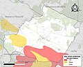 17334-Saint-Georges-de-Longuepierre-argile.jpg 3,057 × 2,480; 575 KB
-
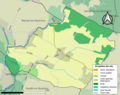 17334-Saint-Georges-de-Longuepierre-Sols.png 3,270 × 2,598; 1.56 MB
-
 17334-Saint-Georges-de-Longuepierre-ZNIEFF2.png 5,866 × 4,133; 3.84 MB
-
 Map commune FR insee code 17334.png 756 × 605; 35 KB


